Picnic: Grand Teton Triathlon
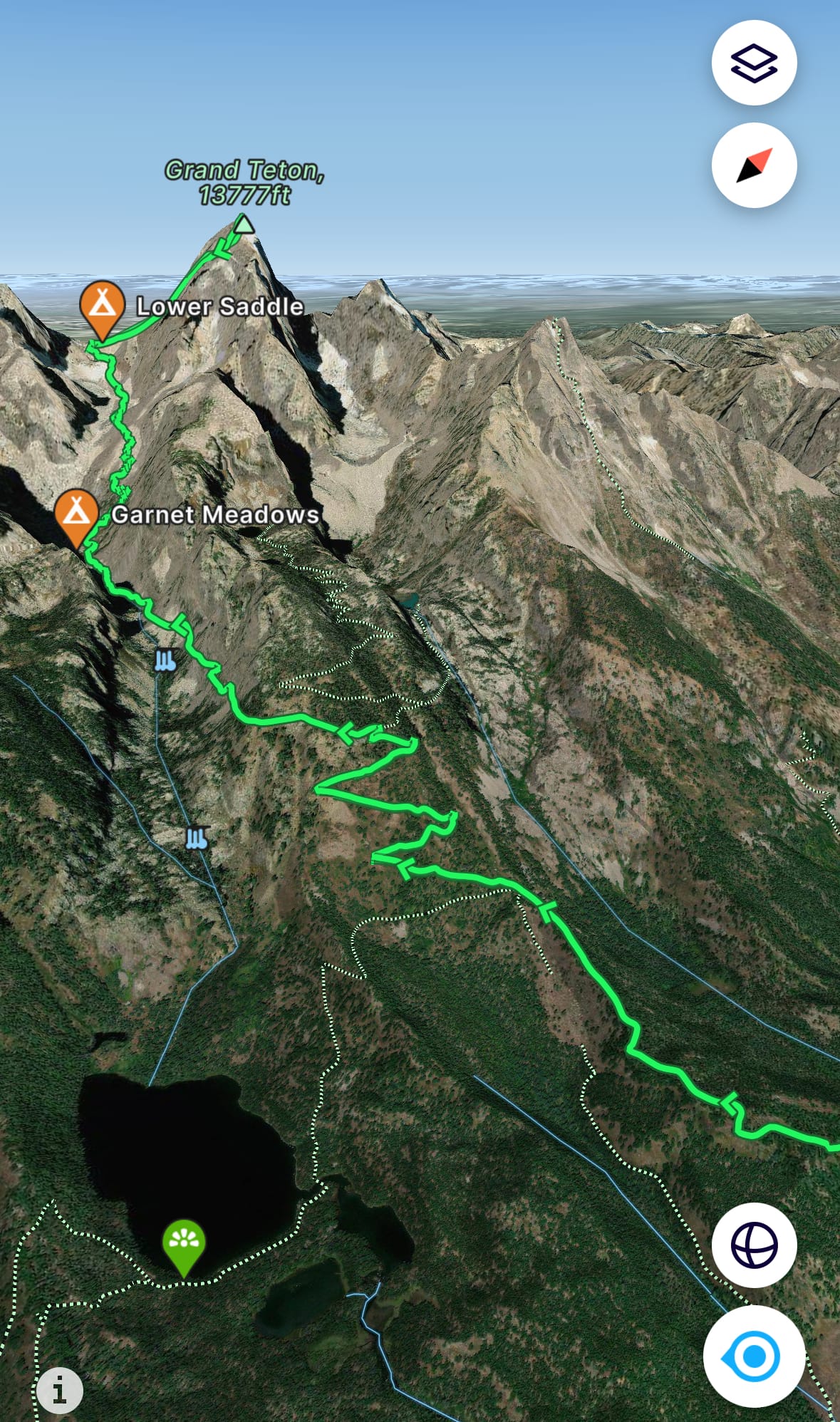
The Grand Teton Picnic is an informal mountain triathlon first completed in 2012. The route:
- First, bike from the elk antler arches in Jackson's Town Square to the Jenny Lake East Overlook (23 miles).
- Second, swim across Jenny Lake to the Cascade Canyon ferry docks (1.3 miles).
- Third, ascend and descend Grand Teton (13,775′) via its 5.4 Owen Spalding route (16 miles / 7,000' vert).
- Fourth, swim back across Jenny Lake to the East Overlook (1.3 miles).
- Fifth, bike back to those elk antler arches (23 miles).
In total, 46 miles of biking, 2.6 miles swimming and 16 miles / 7,000' vert of trail running, hiking and climbing. The Picnic is self-supported – no gear stashing. Anything needed for the climb gets dragged in a wet bag on the swim. Connor, Kelsey and I left town at 2:45am and returned at 9:15pm, an 18.5-hour round trip.
Skip ahead to the trip report: Picnic.
Update: More fun on Grand Teton... a recap of Michelino's controversial 2h 50m 50s FKT that Connor and I witnessed over summer 2024.
 Alex Rienzie
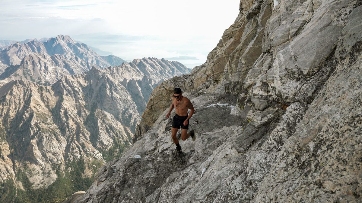
Note: I may get commissions for purchases from links in this post.
FatMap route
Preparation
I first heard about the Picnic in summer 2021, my first full summer in Jackson. It seemed like a pipe dream at the time, especially after a bad case of hiker's knee. But after rehabbing through fall 2021 and a lot of ski touring / conditioning in winter 2022, I thought the Picnic might be doable in summer 2022.
For more context on my winter 2022 training, check out Part I of my "Skillet" post from April 2022. TL;DR: I paused all hiking and running in the fall to rehab my left knee. When I started running again in December, I'd dropped to 10-minute pace for 5 miles. After a winter of nightly Snow King boot-packs and some bigger ski tours, I got myself back to 7-minute pace for 5+ miles.
In May and June, I dialed back cardio, running just one half marathon for kicks (9-minute pace) and a 15K trail race at Jackson Hole Mountain Resort.
After the 15K, I strained my left foot on a Garnet Canyon overnight / South Teton summit, and in general, felt beat up. At that point in June, the Picnic didn't feel realistic. My cardio had room for improvement, my climbing experience was limited to NYC bouldering gyms (shout-out to GP81 in Greenpoint) and I hadn't even summited the Grand yet.

15K (left); Meadows overnight before South Teton (middle/right)
But my foot healed by mid-July. I started feeling the Picnic bug again.
Cardio
To build up cardio, I started trail running a few days a week. I joined a Monday run club in Teton Valley (the Idaho side of the Tetons) called Mountain Ninjas. The group's runs started with modest hill climbs (e.g., a 6-mile / 1,800' vert run to Darby Wind Caves), building up over the summer.
On my own, I started running up Taylor Mountain on Teton Pass or Snow King every other day, much like those nightly Snow King laps in the winter.

Run club (left/middle); Taylor Mtn. (right)
I didn't bother with swim or bike training. I'm a decent swimmer and the paved bike trails in Grand Teton were my least concern. (Spoiler: or so I thought...)
Dry Run on Grand Teton Owen Spalding
For details on my OS dry run, check out the full trip report.
The short version: After studying Wyoming Whiskey and some climbing basics, I free soloed OS in 11 hours trailhead-to-trailhead. I had enough energy in reserve to feel comfortable attempting the climb after the Picnic's initial bike and swim.
More Conditioning on Teewinot
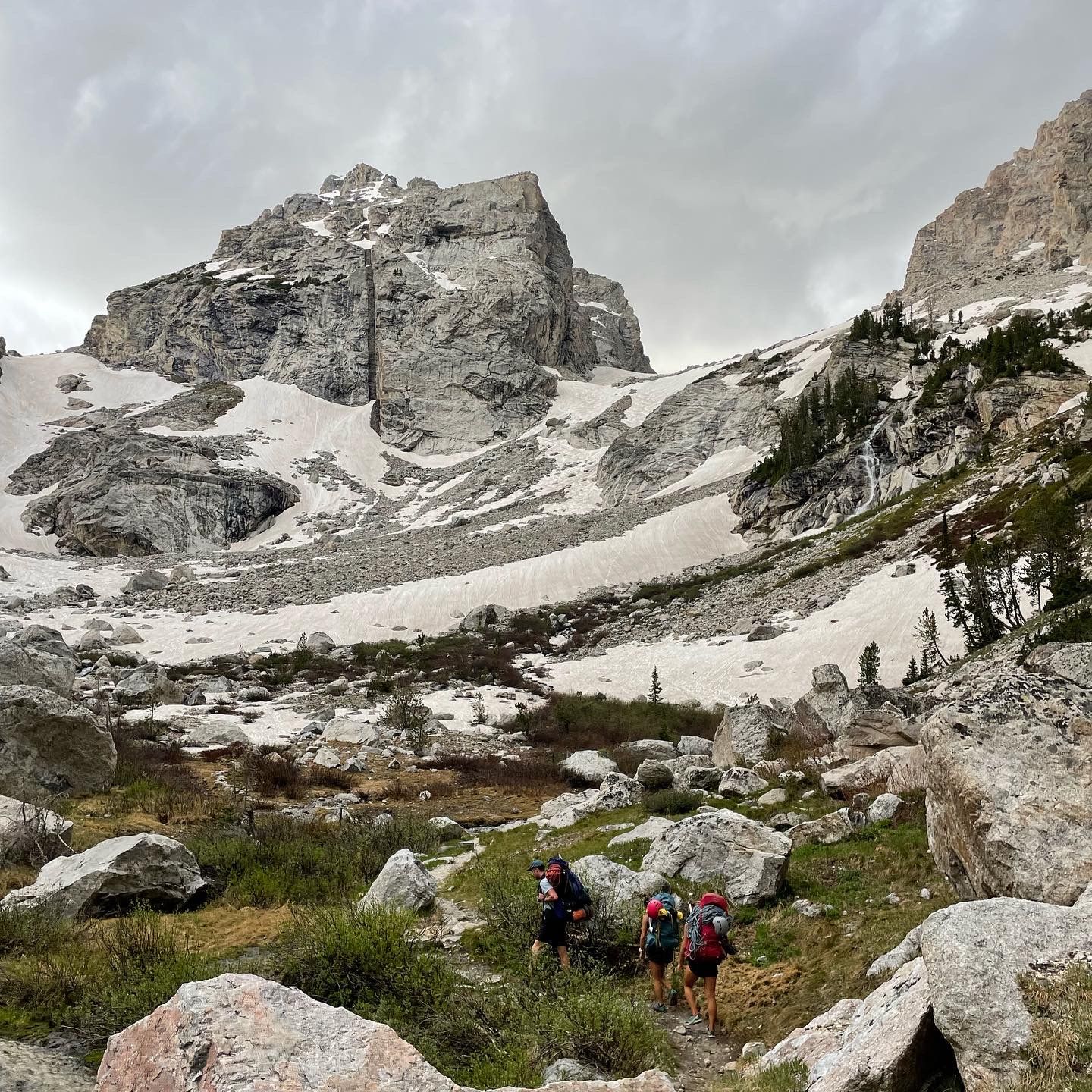
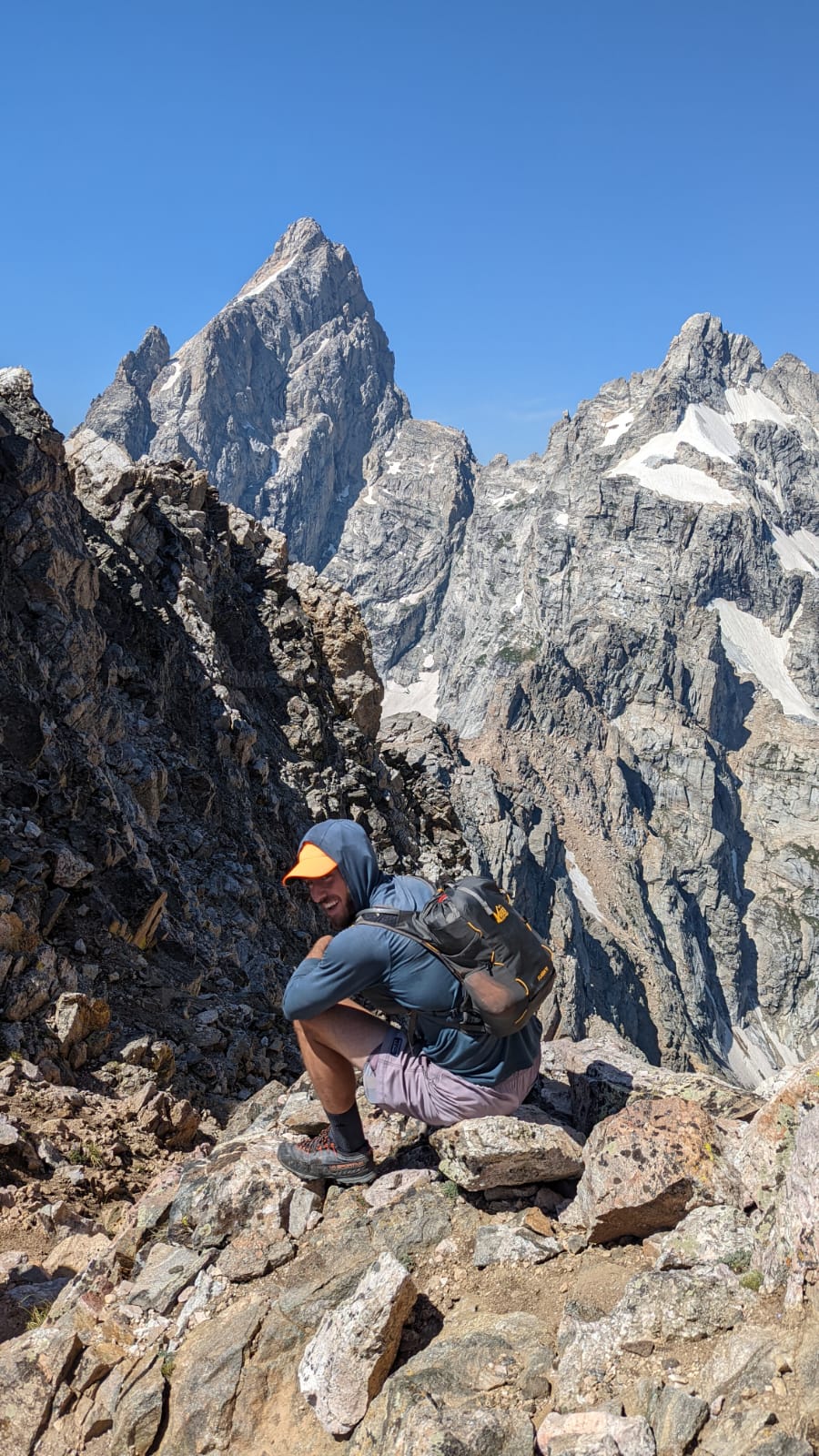
After OS, I joined Helen Gurina on a Teewinot summit. (Helen also helped me practice rappelling before the Grand dry run.) Teewi's a 12,330′ summit just east of Grand Teton and accessed from the same trailhead, Lupine Meadows.
While it's rated class 4, Teewi is responsible for the most fatalities in Grand Teton. Route finding can be difficult and it's easy to end up in class 5 terrain. There are also snow crossings early in the season, and without an ice axe and self arrest training, climbers can get in trouble.
The snow largely melted by our August trip, and aside from a couple off-route detours, Teewi was a fun climb. The summit sports some of the best views in Grand Teton, close ups of the Grand and Mt. Owen. It was high on my summer wish list and good conditioning for the Picnic.
Assorted Teewi shots
The Picnic
With conditioning and an OS dry run out of the way, I was ready for the Picnic. Connor and Kelsey returned from a PNW trip and wanted to join. So, we started looking for weather windows right before my mid-August deadline.
The July-early August dry spell gave way to higher humidity and afternoon thunderstorms. The forecast was a moving target. Monday, August 15th, seemed like our best bet, so we locked it in and hoped for the best.
On Sunday night, I organized my gear, lined up rentals and carbo loaded. To increase the odds of a better night's sleep than my OS dry run, I grabbed a pack of Olly sleep gummies (Melatonin and L-Theanine). Sometimes it's hard to fall asleep with big-objective nerves.
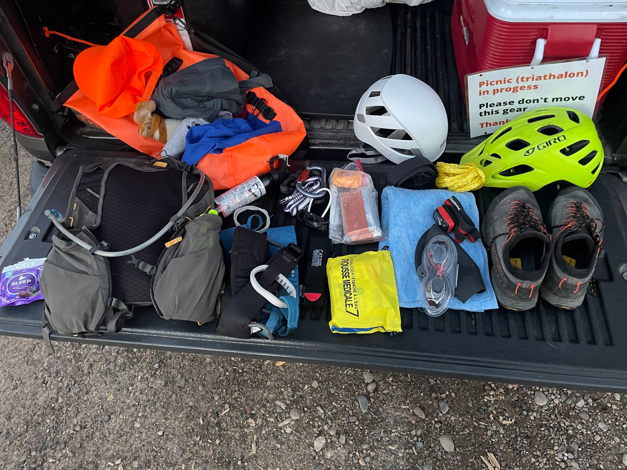
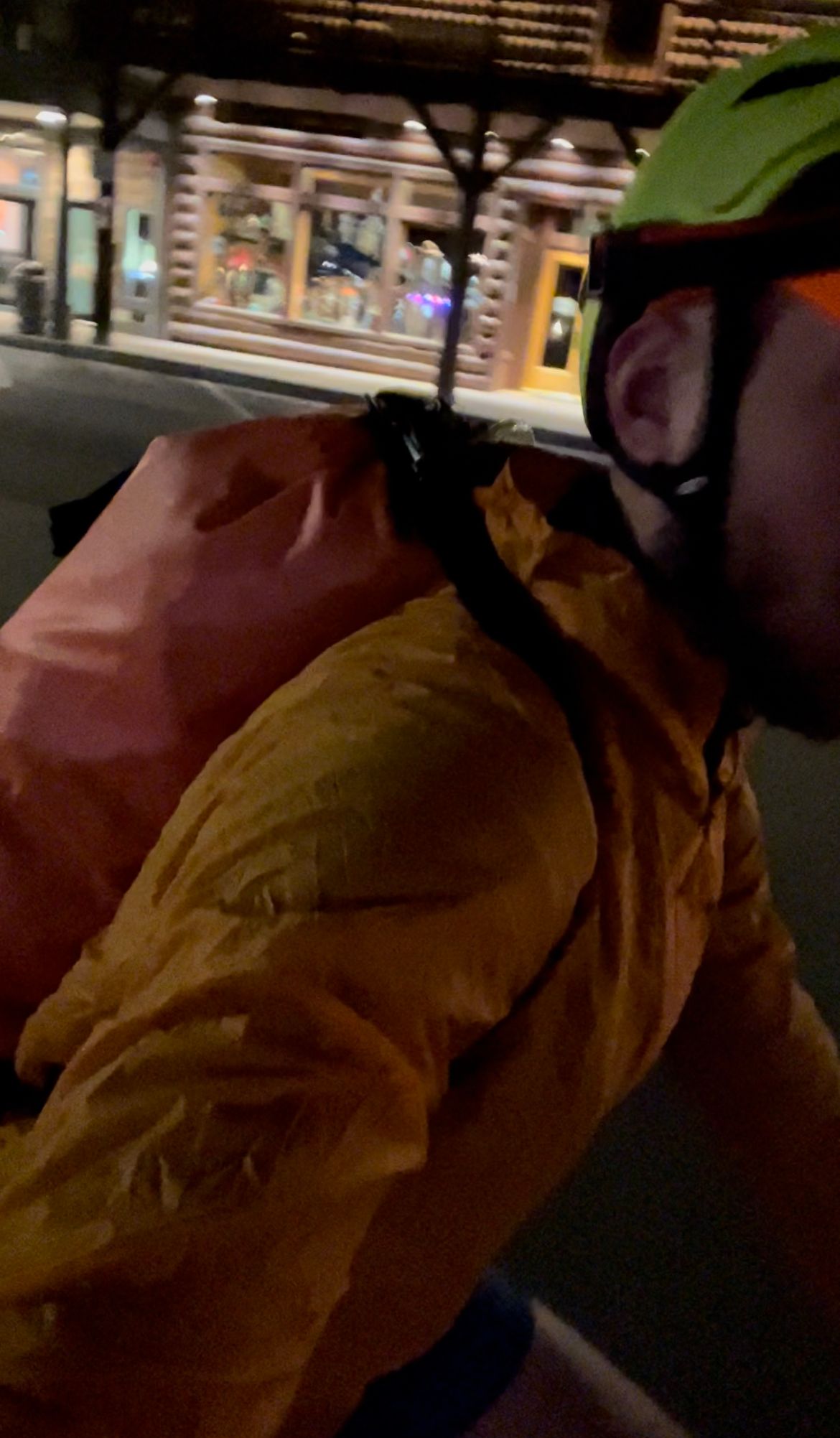
Gear
I packed climb gear in my vest pack, then slipped the vest, helmet, wetsuit and swim gear (goggles, chord and belt) into the wet bag. I settled in for a 5-hour nap before the scheduled 2am wake-up.
- Road bike and bike helmet (rented from Hoback Sports; only have a hybrid gravel bike in Jackson)
- Long, 4 / 3mm wetsuit (rented from Rendezvous River Sports; my wetsuit was in Florida with my surfboard)
- 30L Marchway dry bag (wish I got a larger size), plus backup Ziplock bags for electronics (phone and portable charger)
- Section of floating chord from ACE Hardware and a belt from Arcade to drag the wet bag on the swim
- 15L REI vest pack
- Petzl climbing helmet
- Black Diamond Momentum harness
- Three carabiners: one large, auto-locker for my belay device and two smaller ones for my daisy chain (personal anchor) and prusik (for a third hand)
- Black Diamond ATC belay device
- Gloves from ACE Hardware (in the dorkiest yellow I could find)
- Extra socks (wool) and underwear for the climb (left the first pair from the bike/swim hanging to dry with our wetsuits)
- Bear spray (limited sightings on the route with all the traffic, but the occasional black bear and less frequent grizzly)
- Black Diamond LED headlamp
- Tinted Speedo goggles (should've bought a clear pair for the night swim)
- Camp towel for transitions
- Sportiva TX4 approach shoes
- Laminated sign from Staples to ward off well-meaning tourists from returning our wetsuits to the lost and found (unlikely, but who knows)
- Blaze orange ball cap (originally for hunting, but always good to be visible)
- LifeStraw filtered water bottle (on my list to buy a flexible version that can fill up other containers, like a bladder)
- Food: GU gels, Clif bloks, RX bars, etc. (I've gotten in the habit of using ziplock bags to keep food organized)
- Electrolyte powder
- Emergency gear: first aid kit, tourniquet, space blankets, Gorilla tape, baby powder (for chafing), Leatherman multi-tool, lighter, whistle, Ibuprofen, Voile straps (multiple uses)
- Portable charger for my iPhone
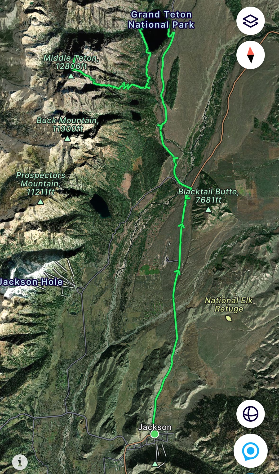
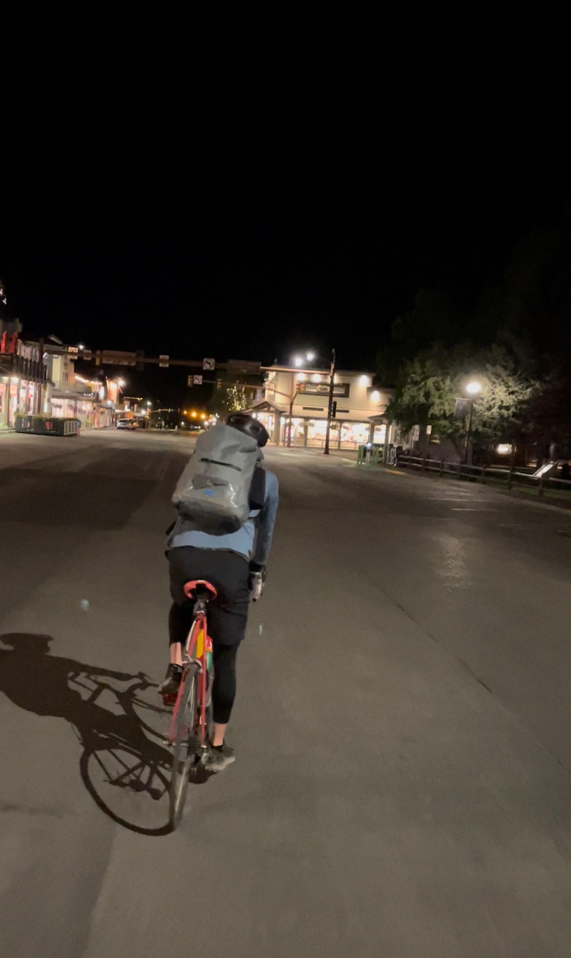
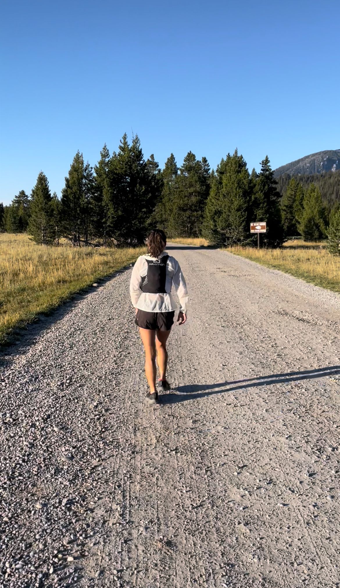
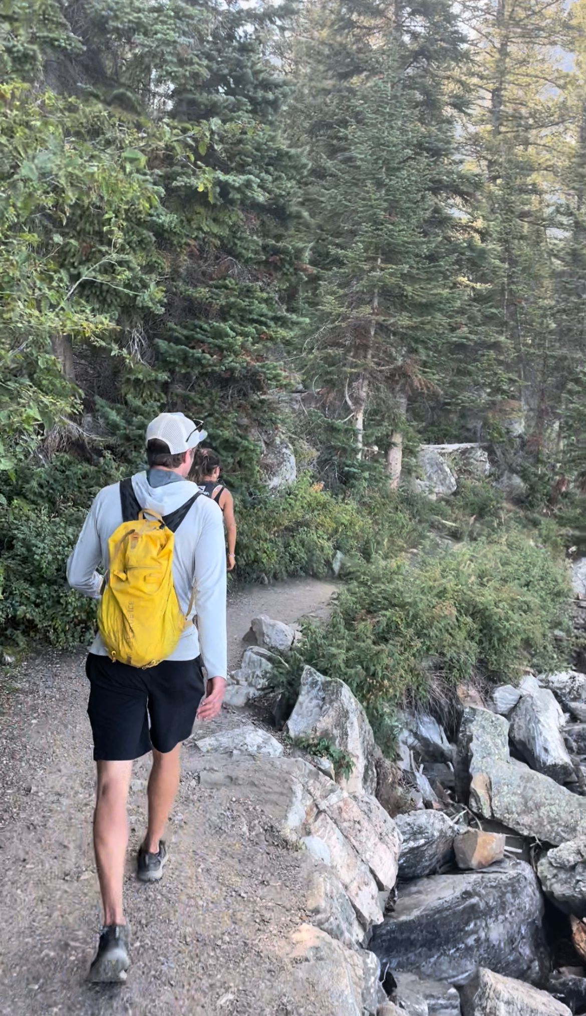
1. Bike from Town Square to Jenny Lake (23mi)
At 2am, I woke up and pulled myself together for a 2:30am rendezvous near the Town Square. We parked a couple blocks away, organized gear, and by 2:45am, biked to the Square.
It was a mild, clear night with temps around 50-60F, so a windbreaker over my sun hoodie was plenty warm. We cruised past the elk antler arches, heading north on US 191 / 89. The bike path starts by the Dairy Queen, gaining just ~500' of elevation gain over 23 miles.
A near full moon lit up the valley and mountains. A gentle breeze rolled over the Gros Ventre Butte. Before we knew it, we turned left at Moose Junction. We surprised one elk herd just before the Taggart Lake parking area. (Barely made out their silhouettes floating across the bike path ahead.)
As we approached the Cathedral Group (a collection of summits around the Grand), we started seeing headlights. One party worked up the switchbacks just past Lupine Meadows, a few more rustled on the Lower Saddle and another seemed to be summiting Mt. Owen. Grand Teton never sleeps.
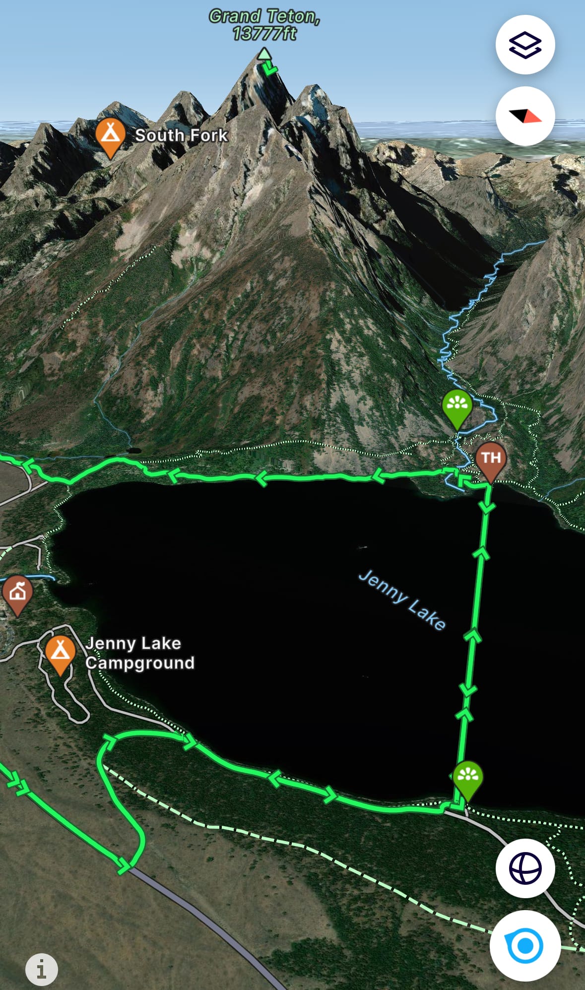
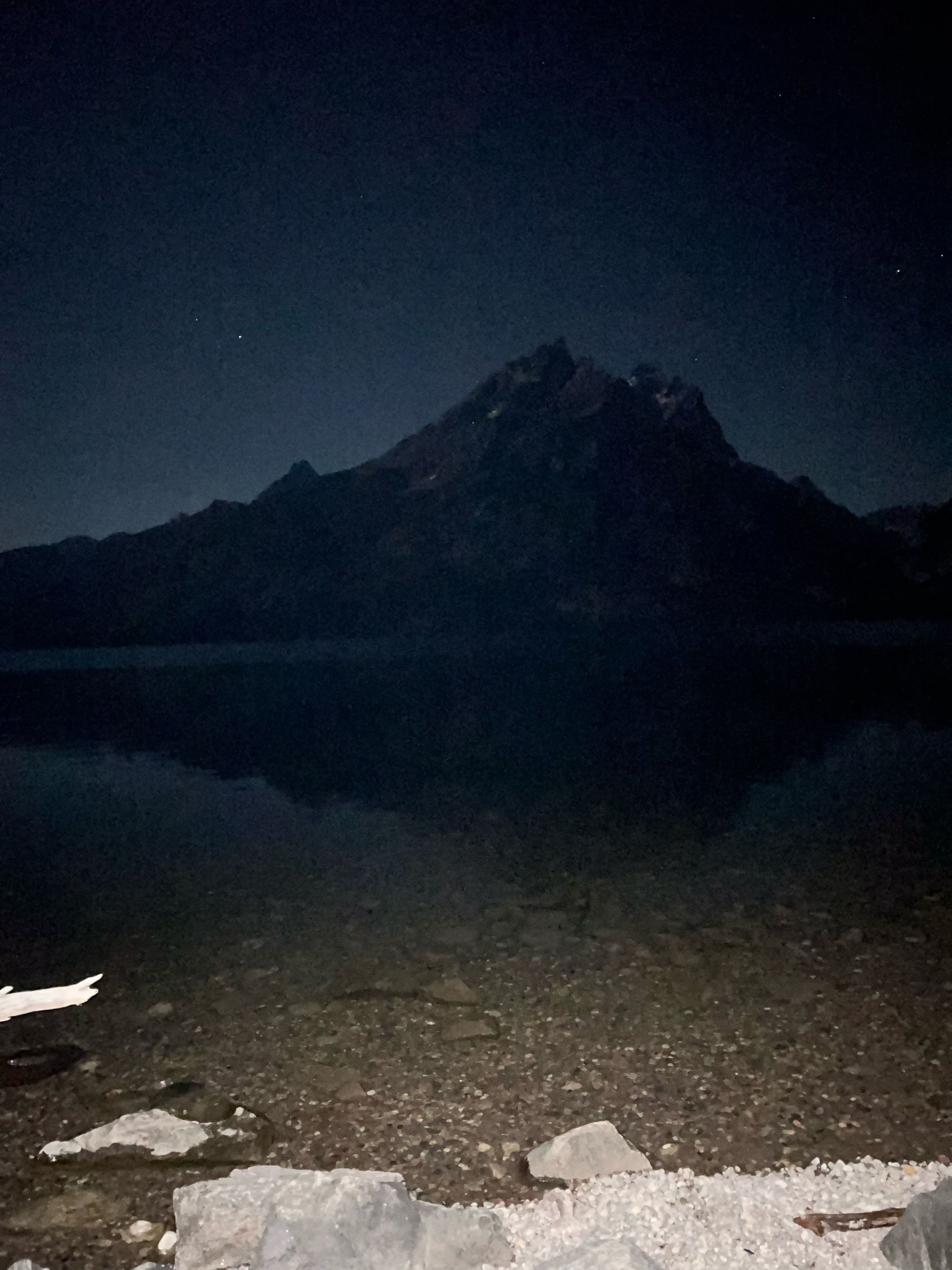
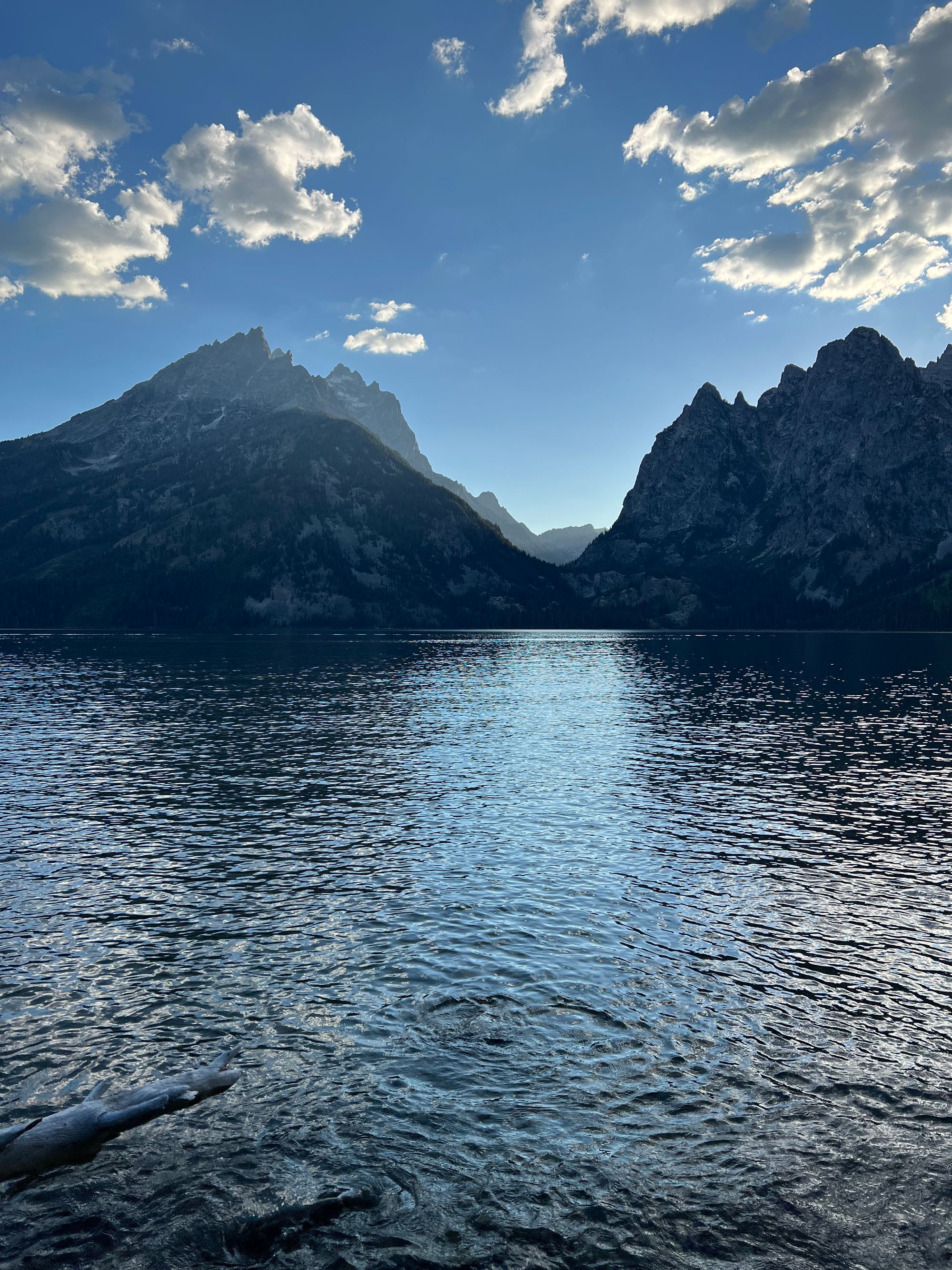
At 4am, we stopped at South Jenny Lake for a bathroom stop, then weaved through the bike trail to Jenny Lake's Scenic Drive. The Picnic swim starts at the East Overlook. According to Gonzalez, that east-west route is intended to make Picnickers swim directly at the Grand.
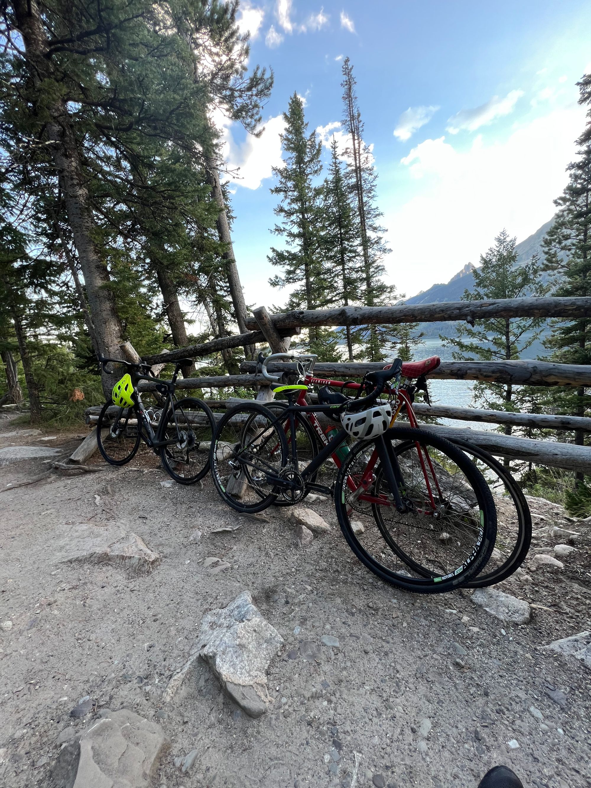
By 4:25am, we locked up our bikes and scrambled down the steep hillside to the lake shore.
Leaving Town Square (left/middle); locked up at the East Overlook (right)
2. Swim across Jenny Lake (1.3mi)
We emptied our wet bags on the rocks and started transitioning to wetsuits. We lucked out with mild weather. It took us awhile to transition. My rental wetsuit's zipper kept going off track and we all had trouble squishing gear into wet bags.
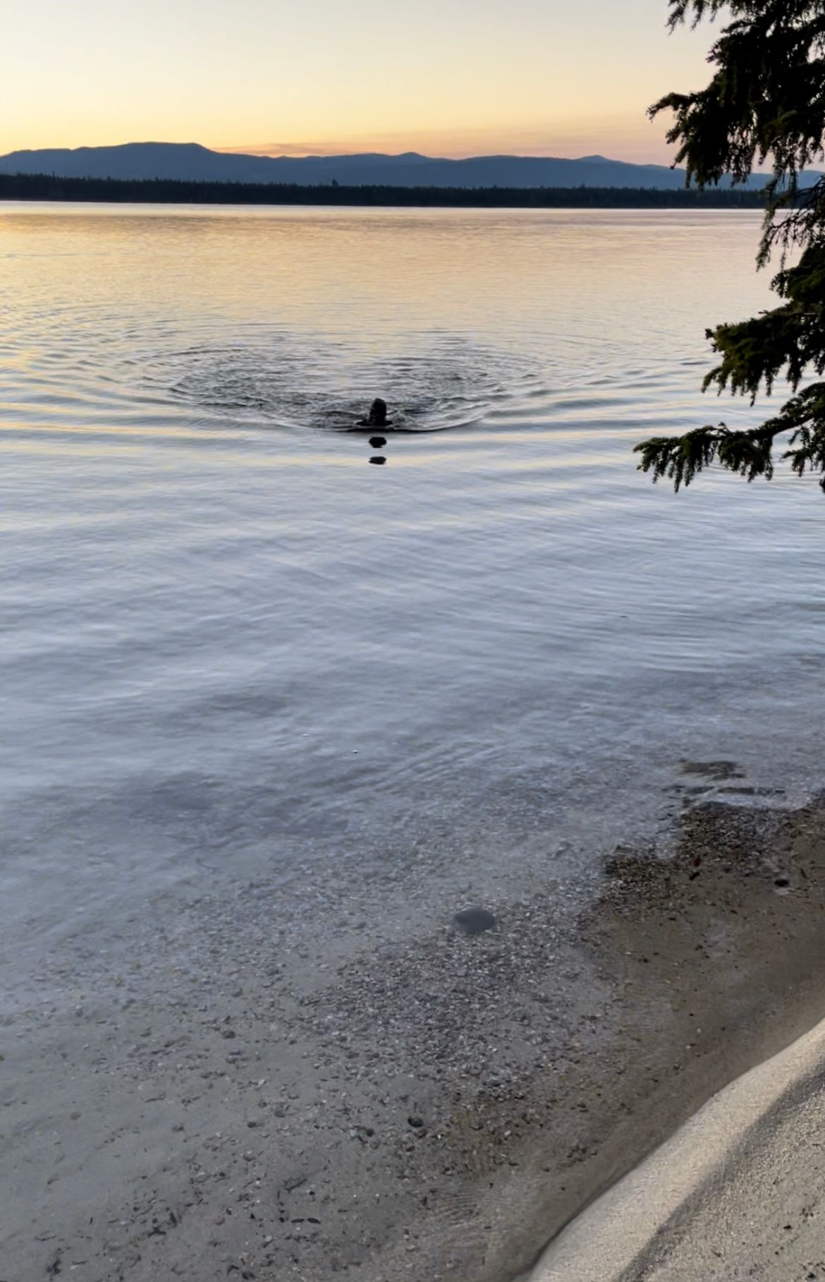
After 20 minutes, we finally waded out on the slippery rocks and into Jenny Lake, wet bags tied to our waists. The west ferry docks were in line with the middle of Cascade Canyon. We could make out its silhouette against the clear sky, though it was harder with tinted goggles.
I alternated between freestyle and breast stroke. I kept removing my goggles to get a better view of the Canyon, thus spending more time on breast stroke. I expected the chord and wet bag to get in the way of kicks, but that wasn't much of an issue. I also considered additional floatation beneath the wet bag (e.g., a boogie board), but the wet bag was plenty buoyant on its own.
Connor accidentally swam ahead and we couldn't find him in the darkness. Knowing he was a strong swimmer with a wet bag for flotation, all we could do was keep swimming.
Everything was a shade of black. The water below was the darkest shade, followed by the mountains, lake surface (twinkling in the moonlight) and a clear sky.
At 5:30am, first light illuminated the landscape like a dimmer switch. We were halfway across the lake, slow time for a ~mile swim. The mountains and canyons slowly took their natural color, dark shades of green and brown.
Approach the ferry docks just after 6am, Connor wasn't in sight on the bank. Still, nothing Kelsey and I could do but swim ashore. I set my feet on a muddy lake bottom off a beach just left from the ferry docks.
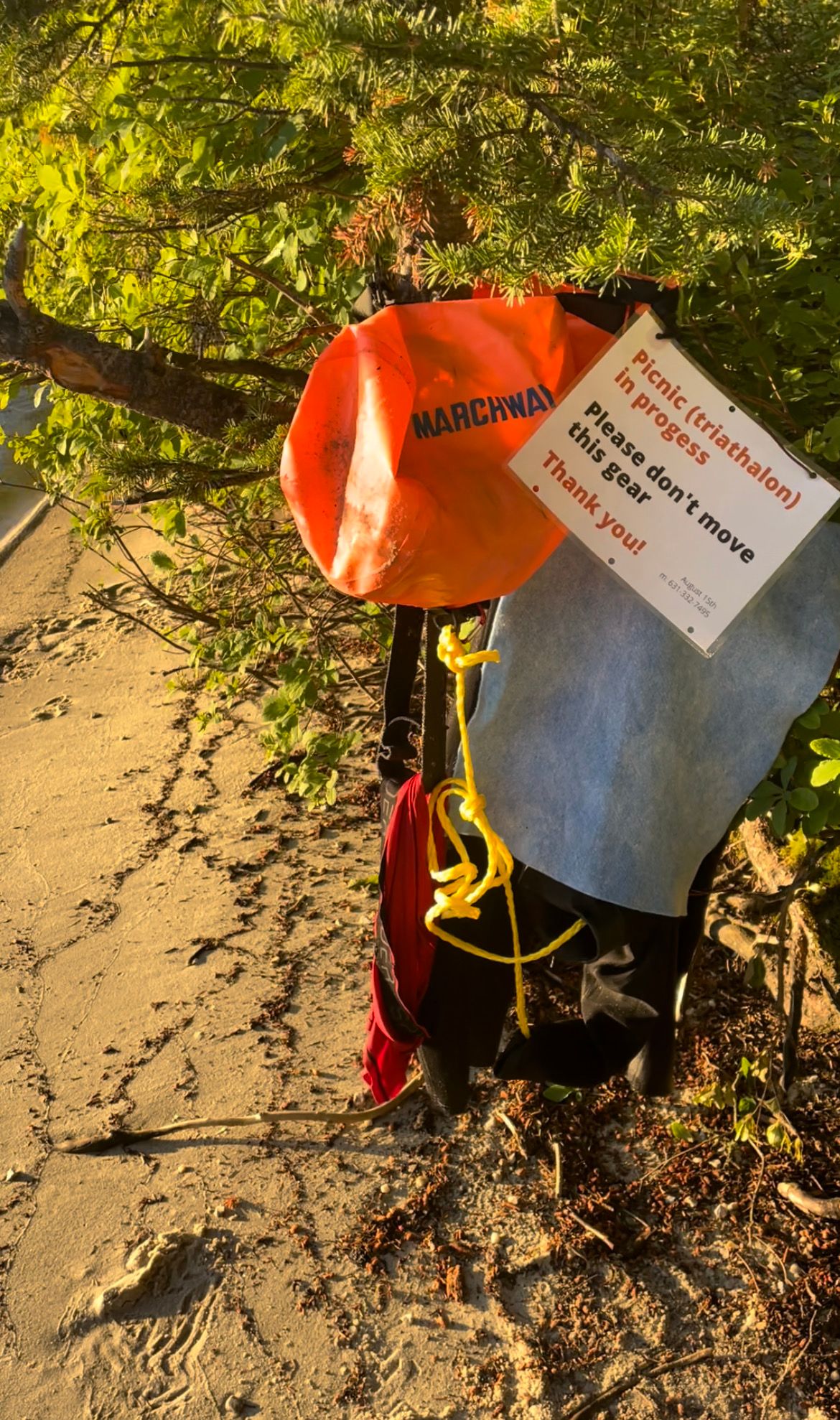
Gaining a better viewpoint on the beach, I spotted Connor swimming behind us. Turns out, he hooked right unable to track Cascade Canyon in the dark. Spotting my orange wet bag after first light, he rerouted. Lesson: bring glow sticks on group night swims. (To my dad's credit, he suggested clipping a beacon to the bag, but I couldn't find a waterproof one at ACE the day before.)
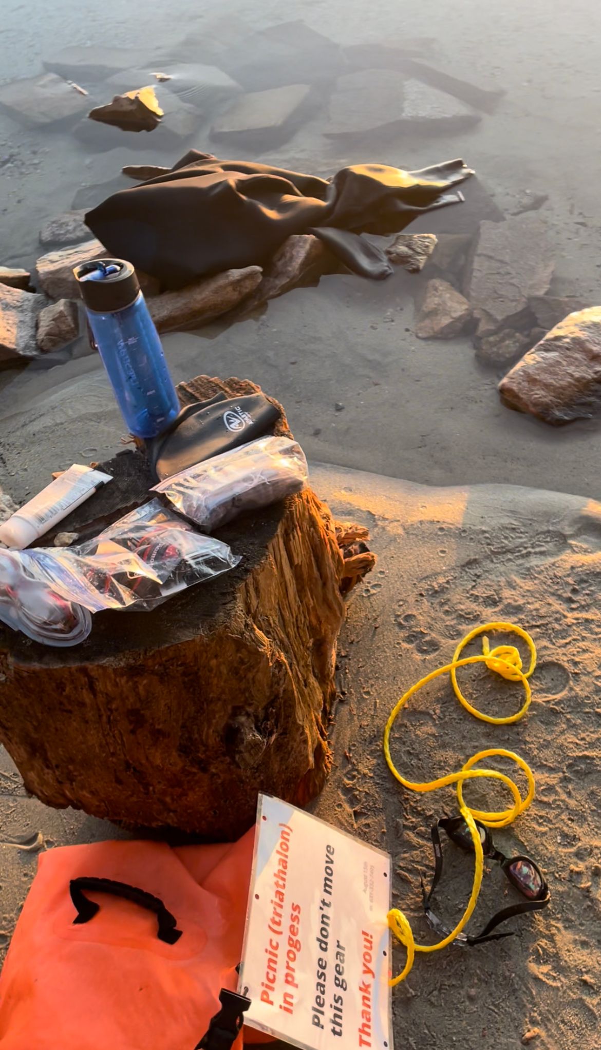
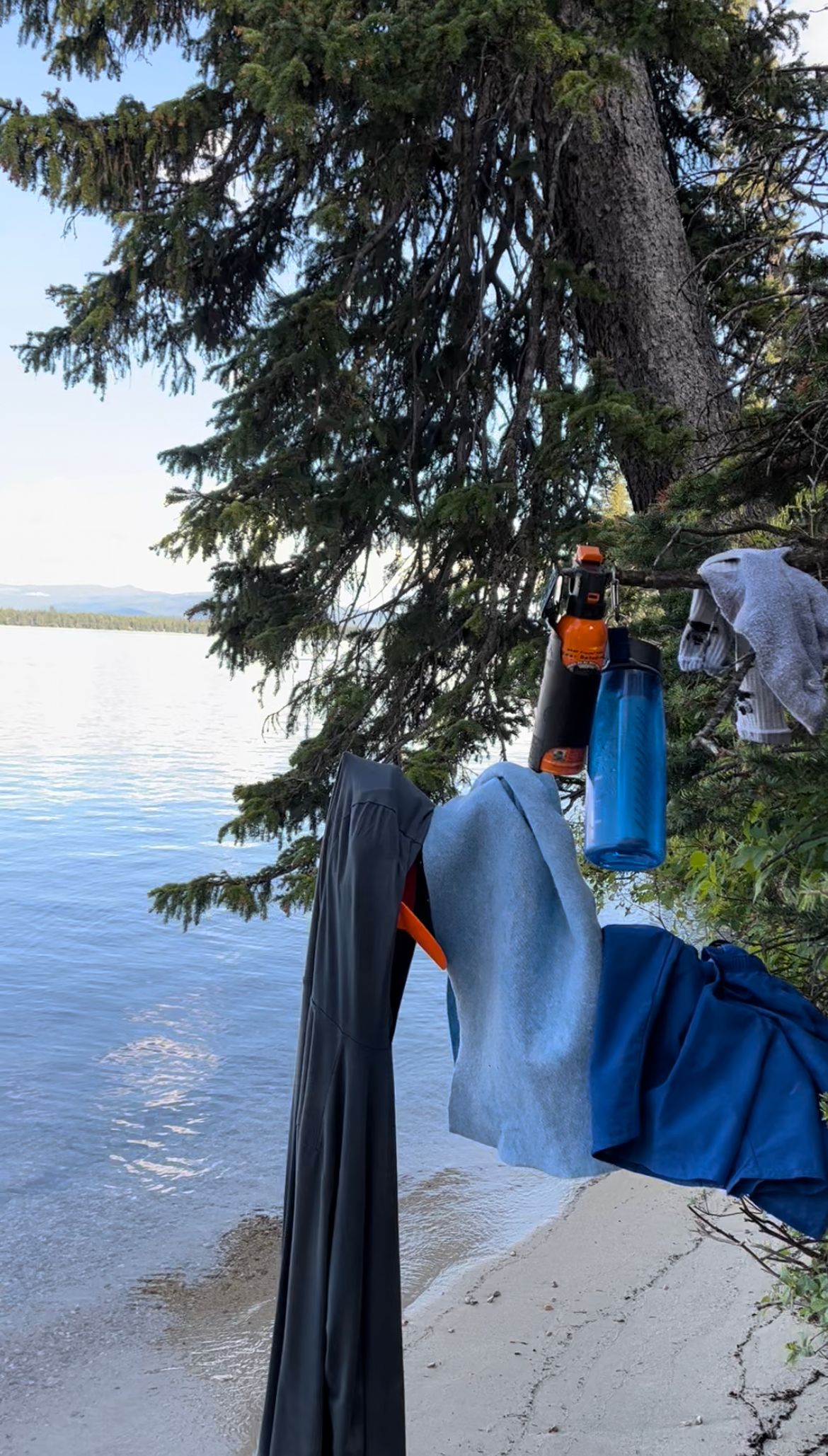
One-by-one we hit the beach and started transitioning for the climb. I changed into fresh socks and underwear, running shorts, a sun hoodie and approach shoes. As we changed, the sun worked its way down the mountains, ultimately landed on our beach. It was just us, Jenny Lake and some geese.
We hung our wetsuits (inside out to make the next swim transition more comfortable) and wet bags on branches surrounding the beach. I also hung my underwear and socks, so they'd be dry for the bike home.
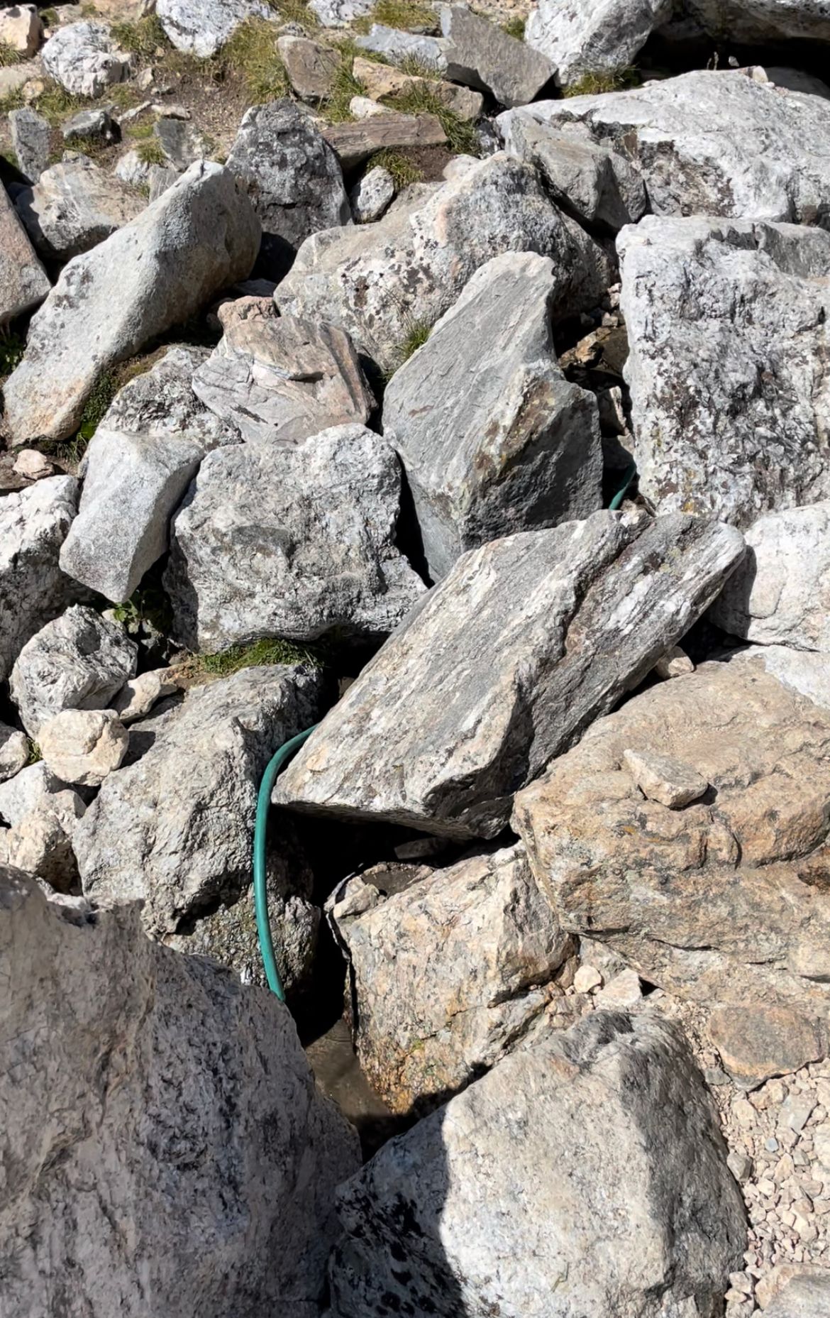
I added the laminated sign to prevent a well-meaning tourist from moving or turning in our gear. Unlikely, but I couldn't imagine finishing ~75% of the Picnic just to be thwarted by missing gear.
At 7am, I tossed on my vest pack and we headed south to Lupine Meadows.
Assorted swim #1 shots, again forgive the sloppy "triathlon" misspelling
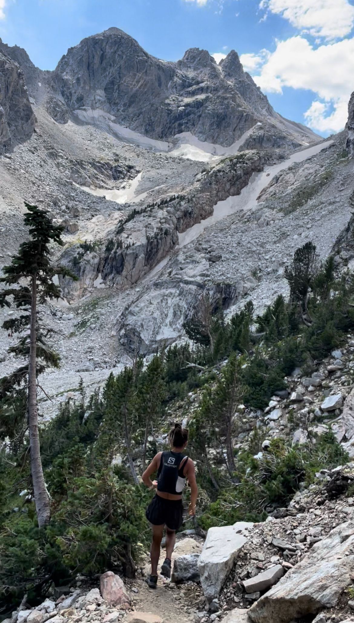
3. Run, Hike and Climb up Grand Teton (16mi / 7,000' vert)
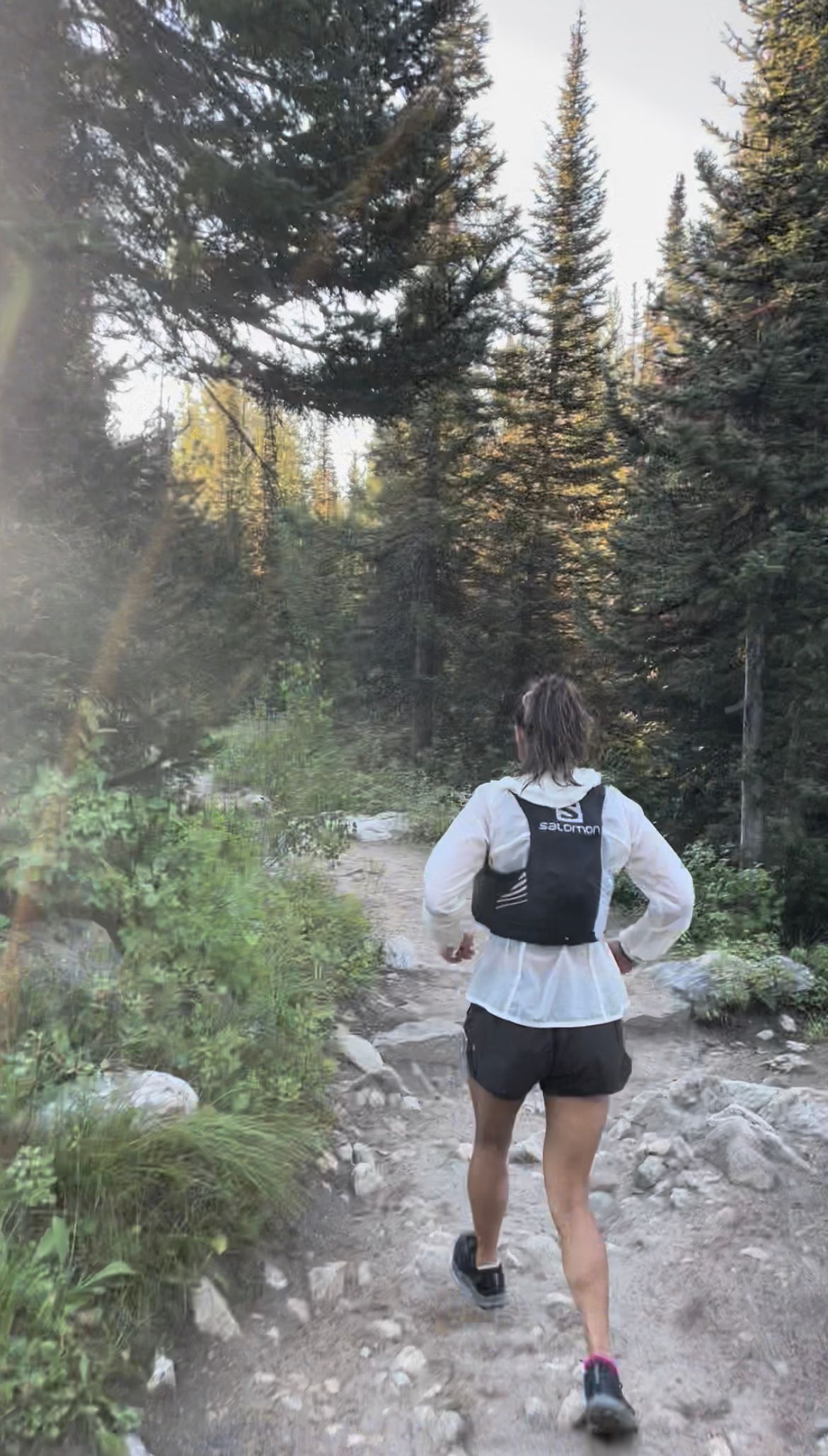
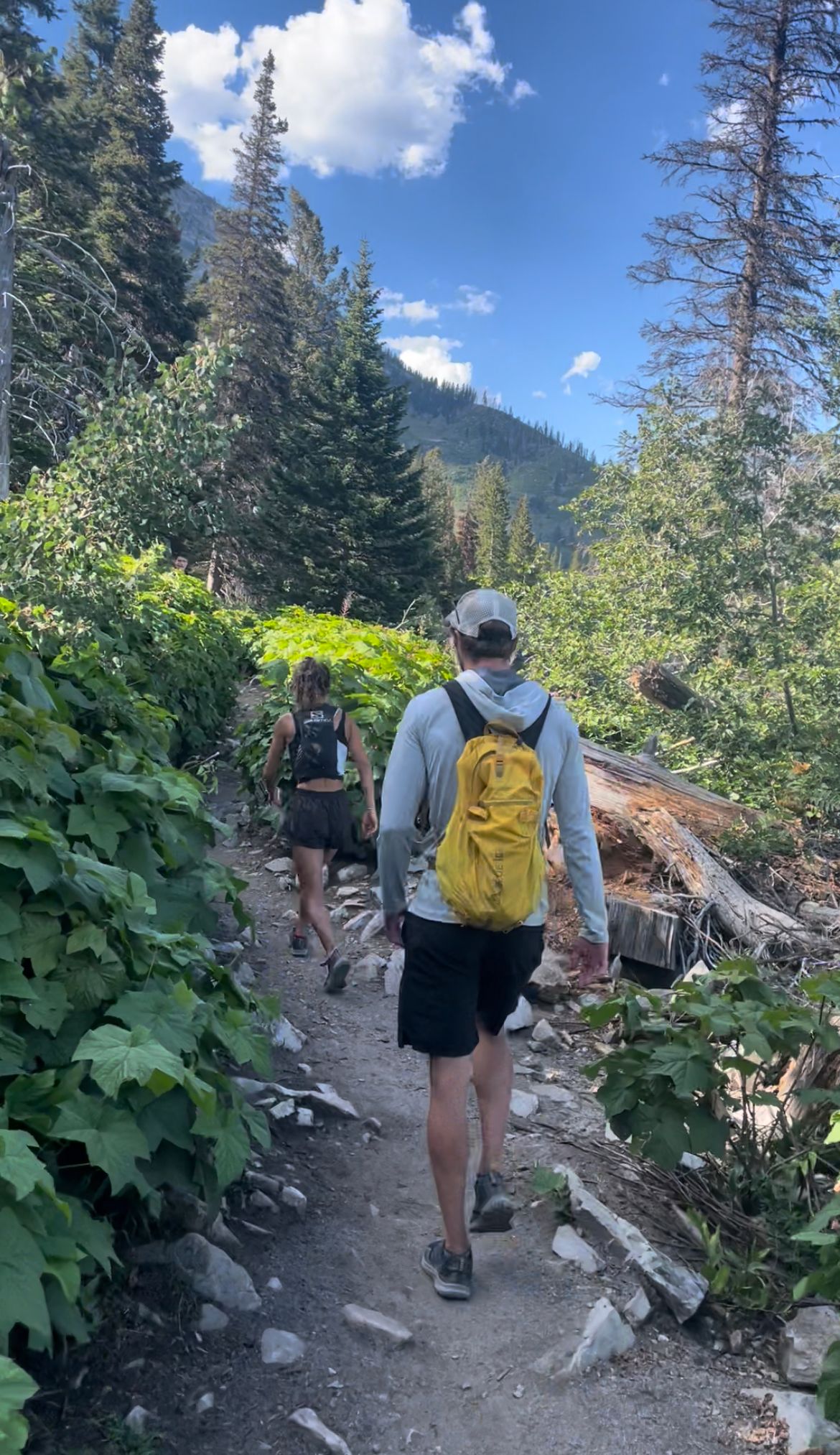
The Picnic adds two miles (each way) to the standard Grand Teton summit. The Jenny Lake trail, south, eventually leads to the Valley Trail, which deposited us at Lupine Meadows trailhead.
We jogged a portion of the Jenny Lake trail. Connor was still recovering from some night swim-induced vertigo (all those shades of black), so we took it easy. We passed a few early-bird hikers on the trail, but nothing compared to the typical afternoon crowds around Jenny Lake.
At 7:45am, we waited in line for Lupine Meadows' one and only outhouse. (Takes forever once the morning crowds roll in.)
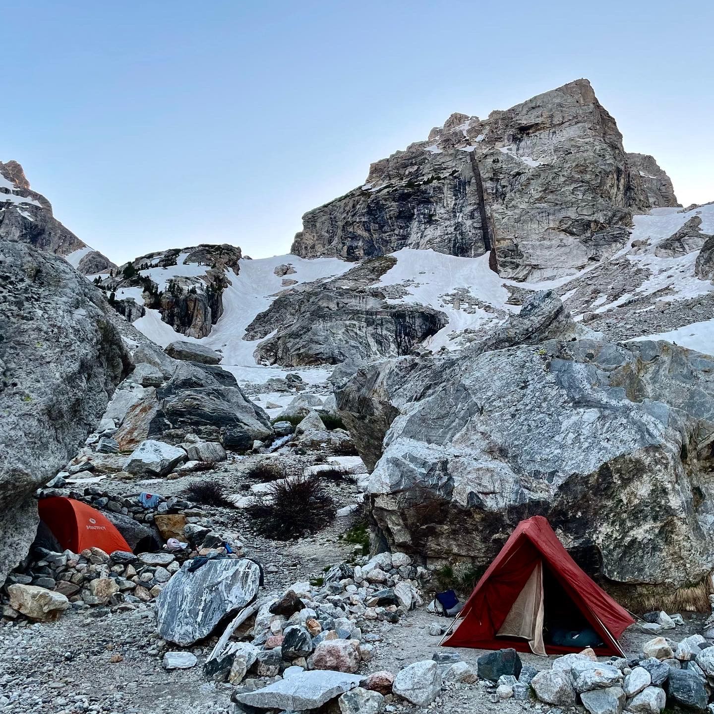
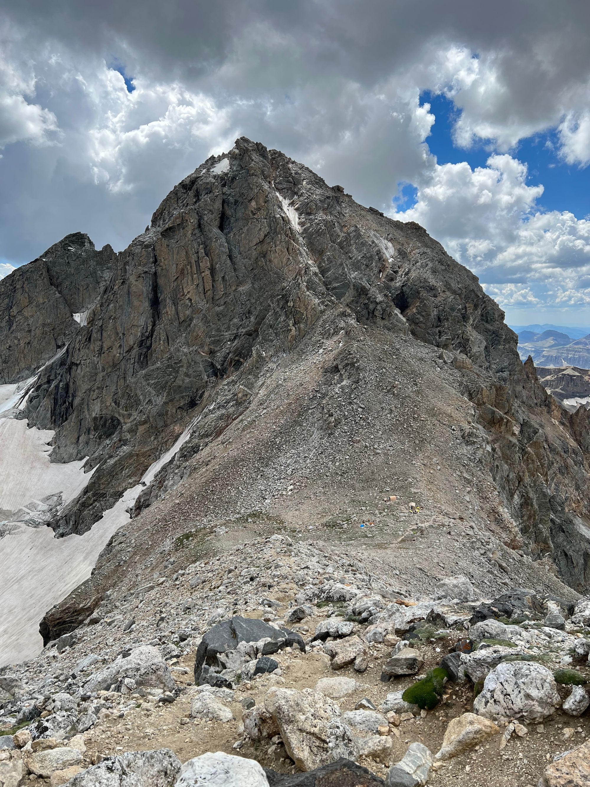
At 8am, we started on the trail, mostly passing day hikers on the ascent. We jogged one section after the switchbacks, getting to the Meadows at 9:15am. After a quick stop at the creek for a water and snacks, we started for the Lower Saddle. (At each prior transition we fueled a bit—good to keep snacking on long days.)
Jenny Lake trail (left); approaching Lupine Meadows (middle); lower switchbacks (right)
By 11am, we reached the Lower Saddle spring for another water and food stop. Right after Fixed Rope, a descending climber realized we were attempting the Picnic and took our picture. Even in the alpine, the weather was mild.
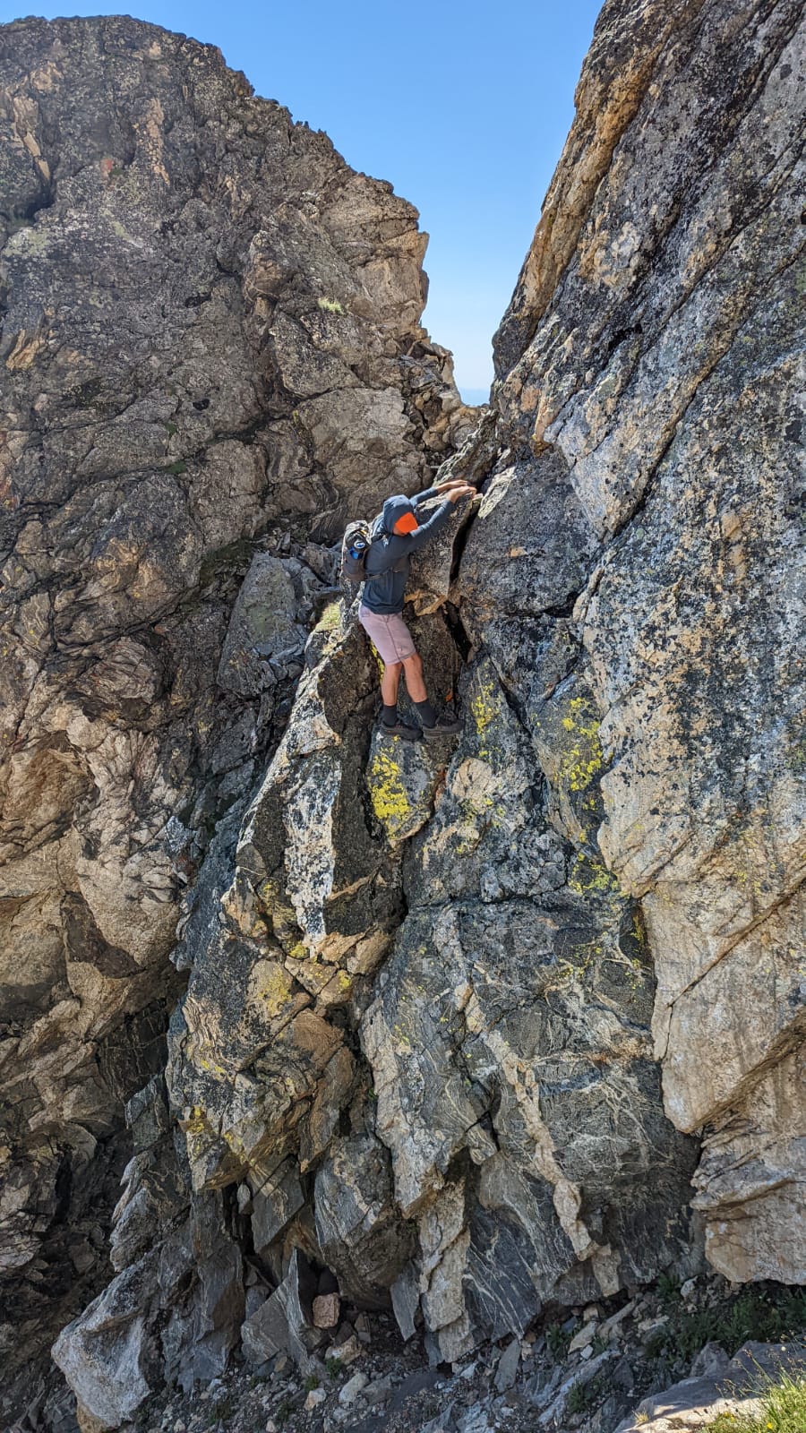
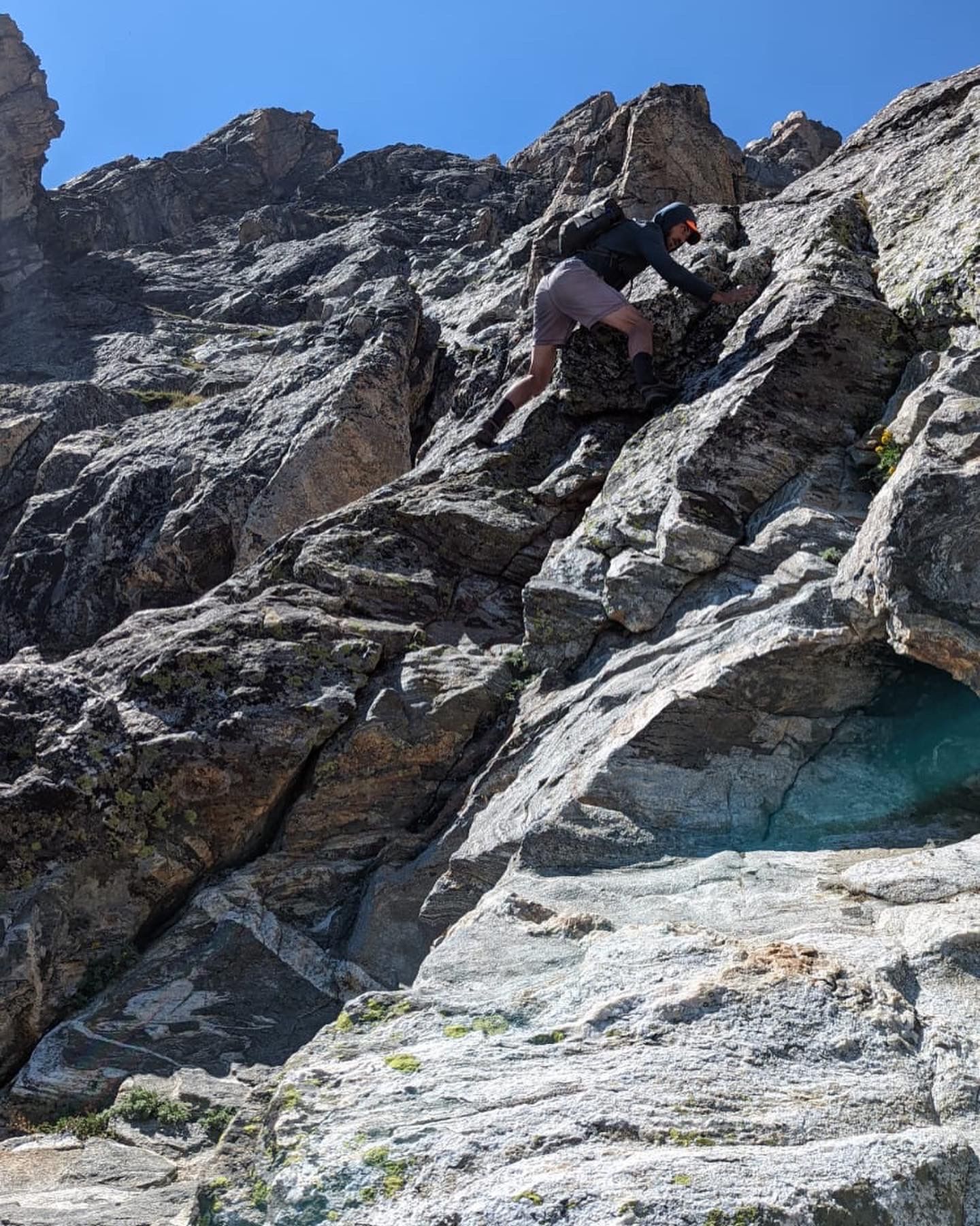
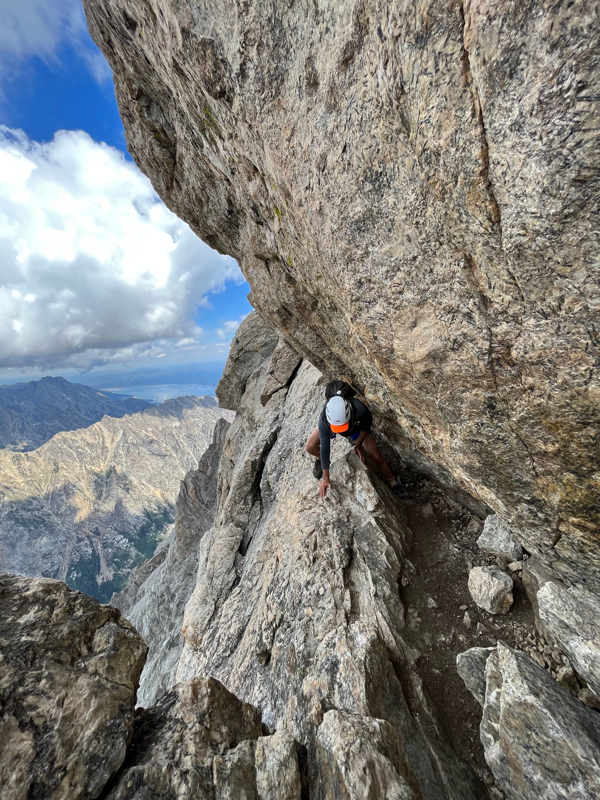
At 12pm, we reached the Upper Saddle, kicking off the OS route. It was later in the day than my dry run and there seemed to be even less traffic. We zipped through Belly Roll and the Crawl, then up Double Chimney. We opted for the Catwalk instead of Owen Chimney since the rock was dry.
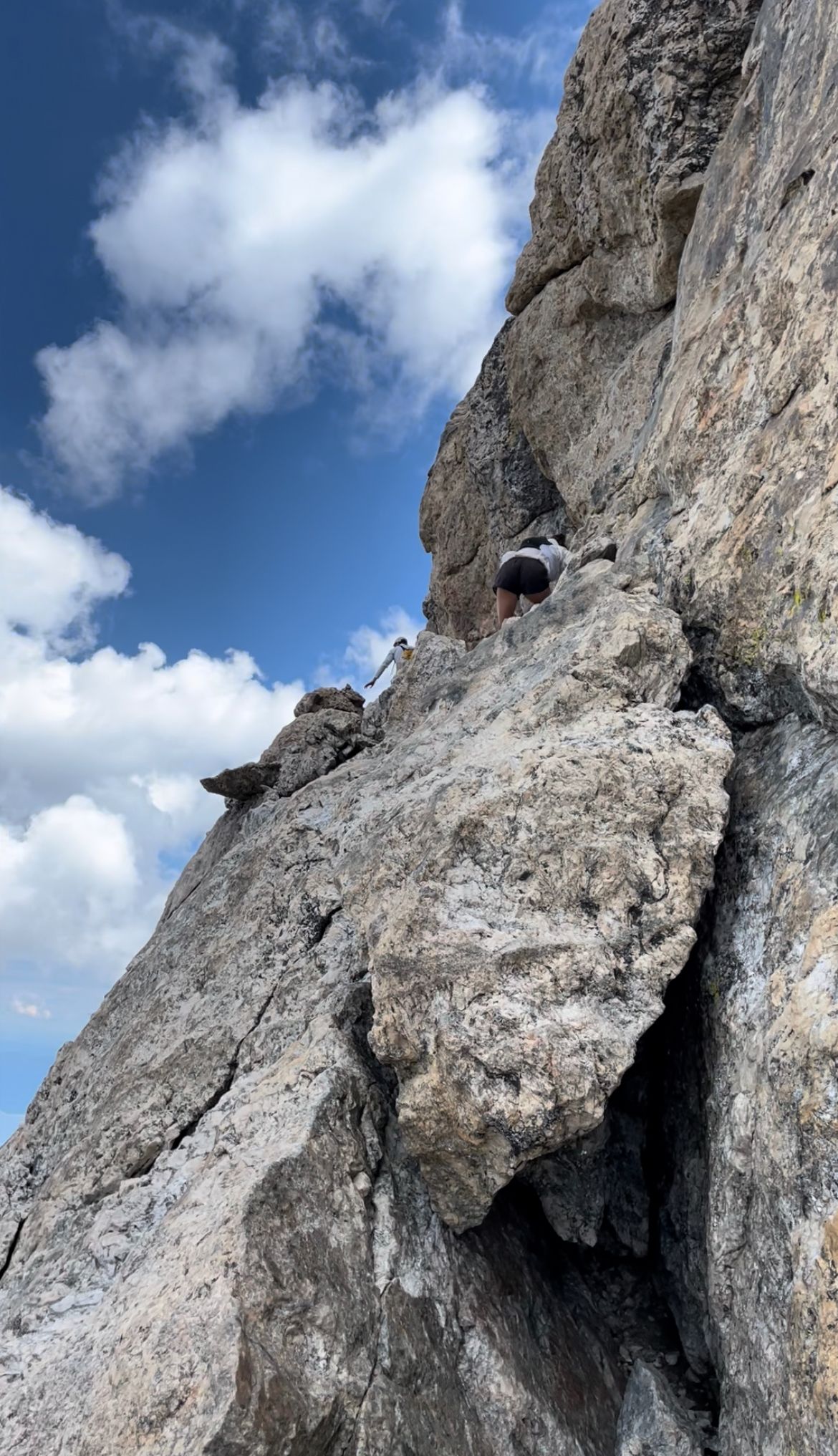
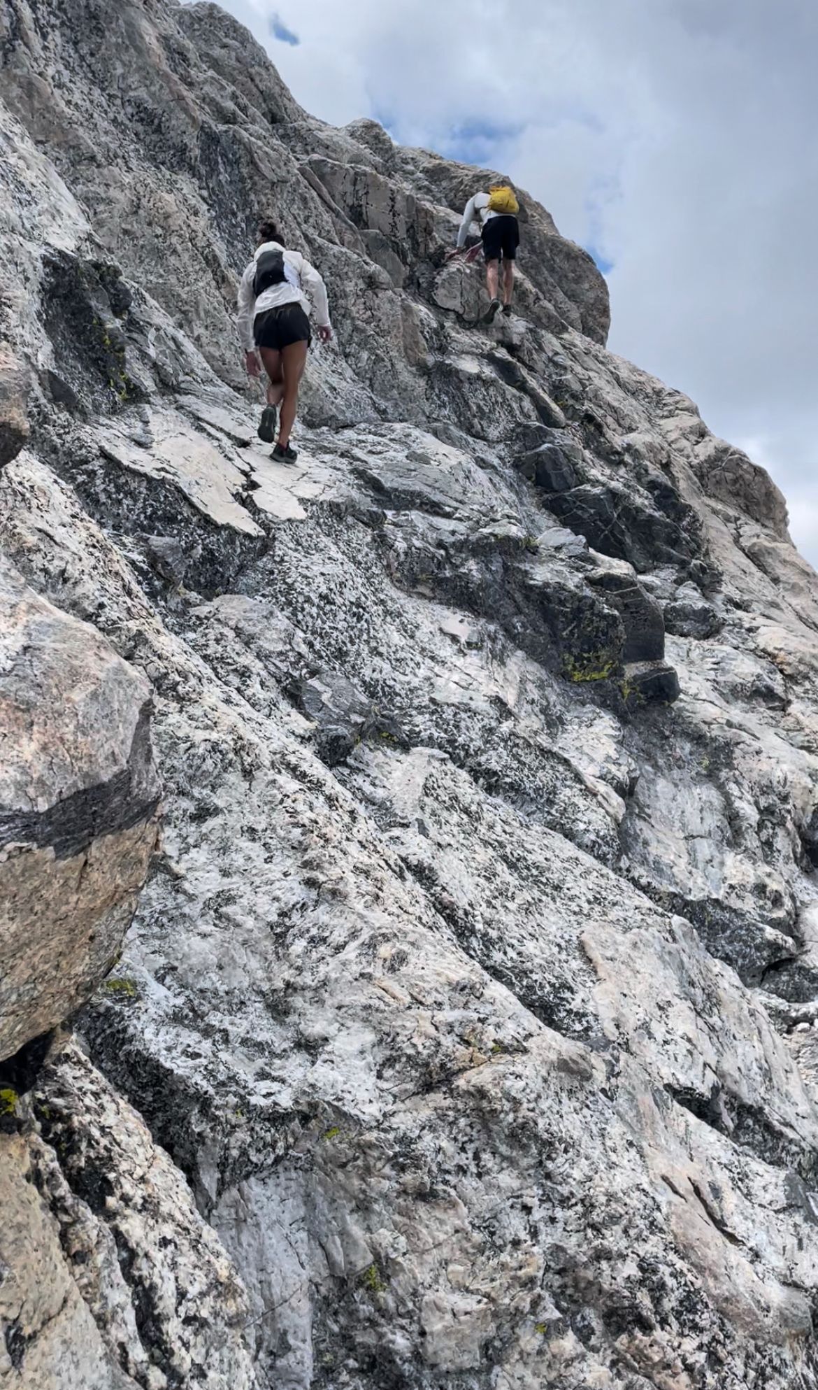
Lower Saddle spring (left); start of OS (middle); Catwalk (right)
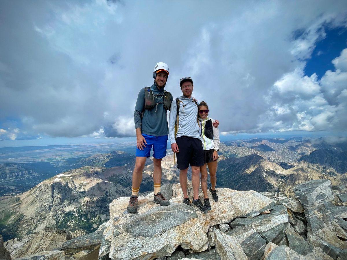
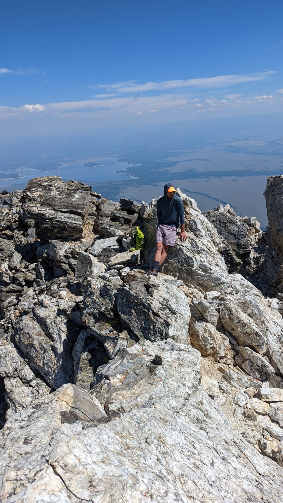
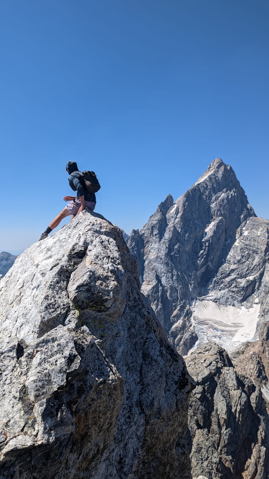
A half-hour later, at 12:3opm, we summited the Grand, just in time for lunch. It took us 4.5 hours from the trailhead, an hour faster than my dry run. (Kelsey and Connor are speedy, so I struggled to keep pace.)
A few small clouds floated by at eye level, a reminder we were "in the clouds." After 15 minutes soaking up the view and some more calories, we started downclimbing.
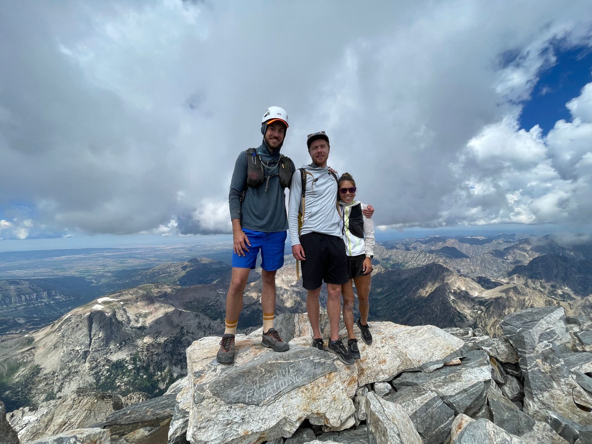
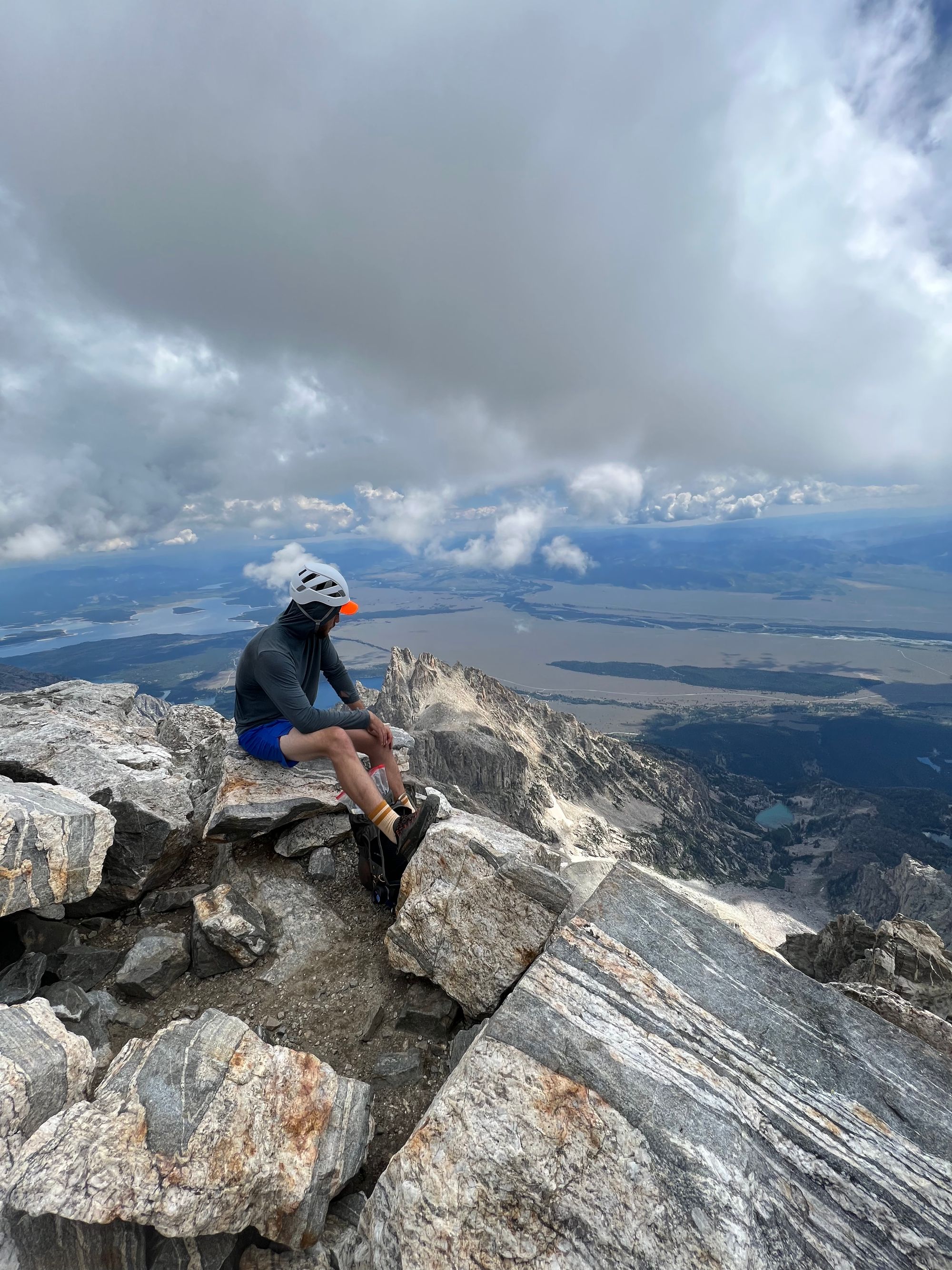
Grand Teton summit
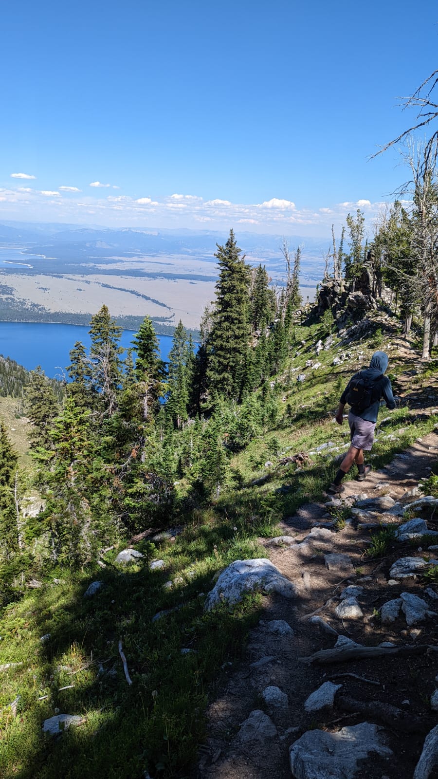
We made another quick water stop at the Lower Saddle, and by 2:30pm, started downclimbing Fixed Rope. After Fixed Rope, we cruised down the switchbacks, jogging the solid sections of trail. Within an hour, we passed through the Meadows boulder fields.
We ran into more traffic on the lower switchbacks, jogging past at least 30 groups. I cramped up at one point, but was able to work them out and keep running.
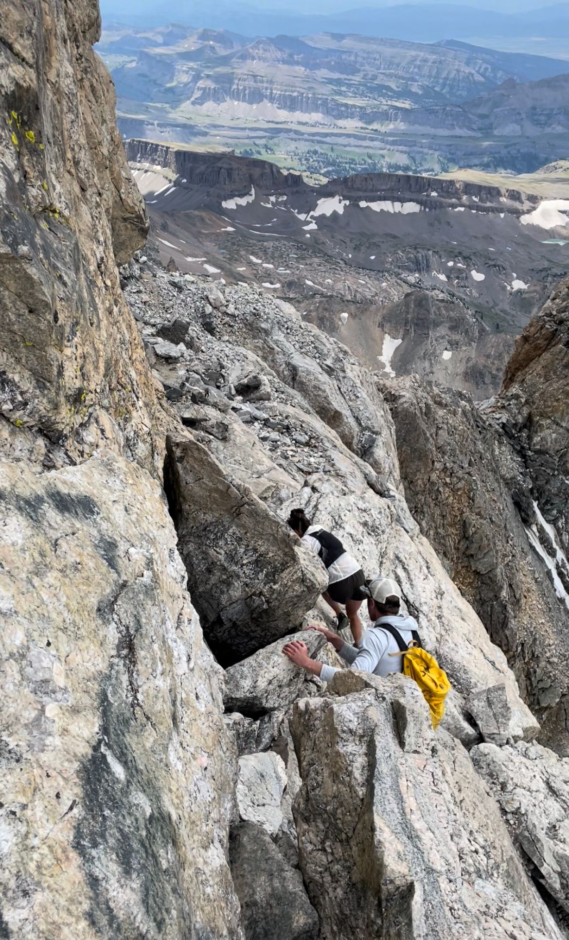
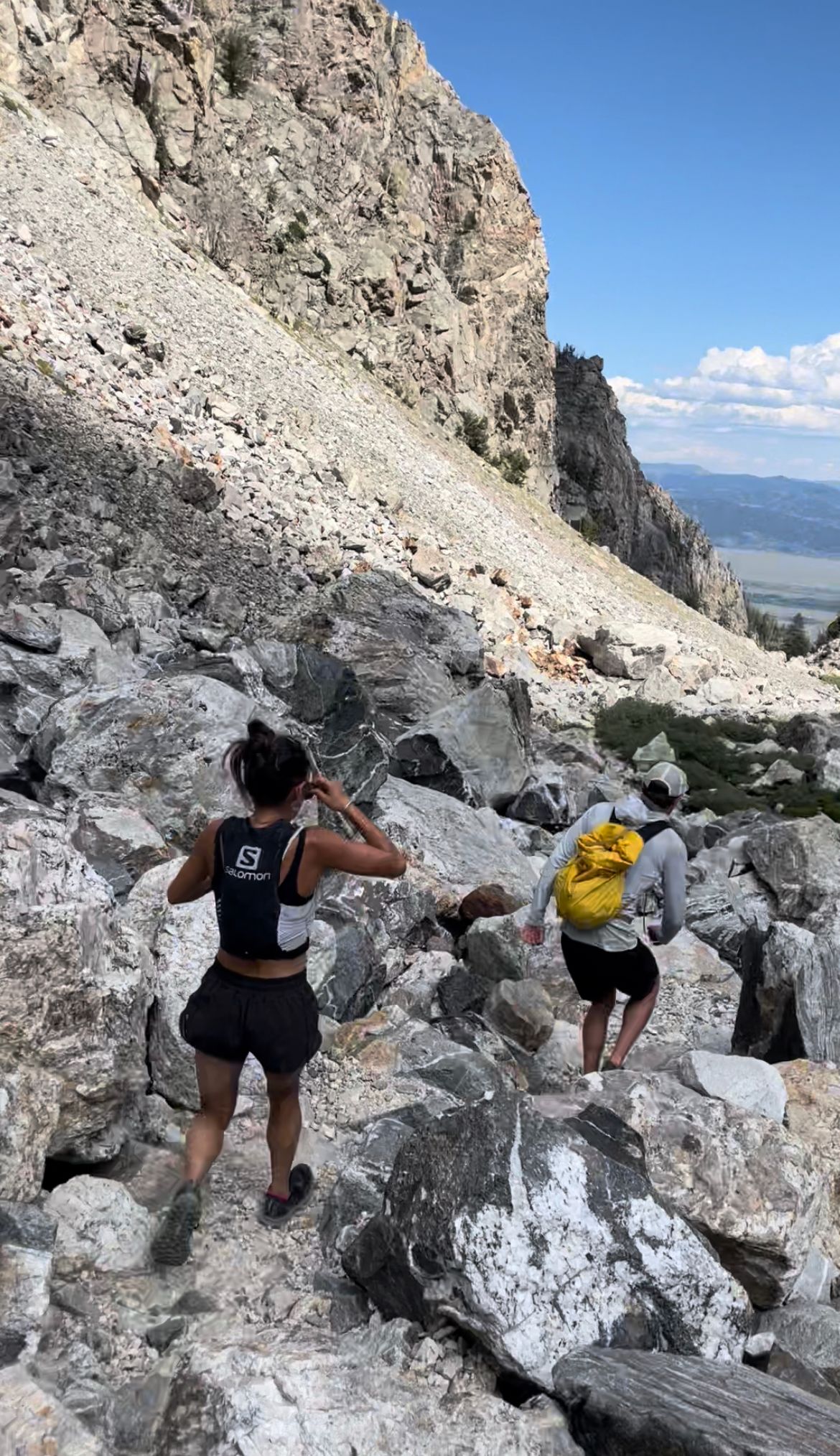
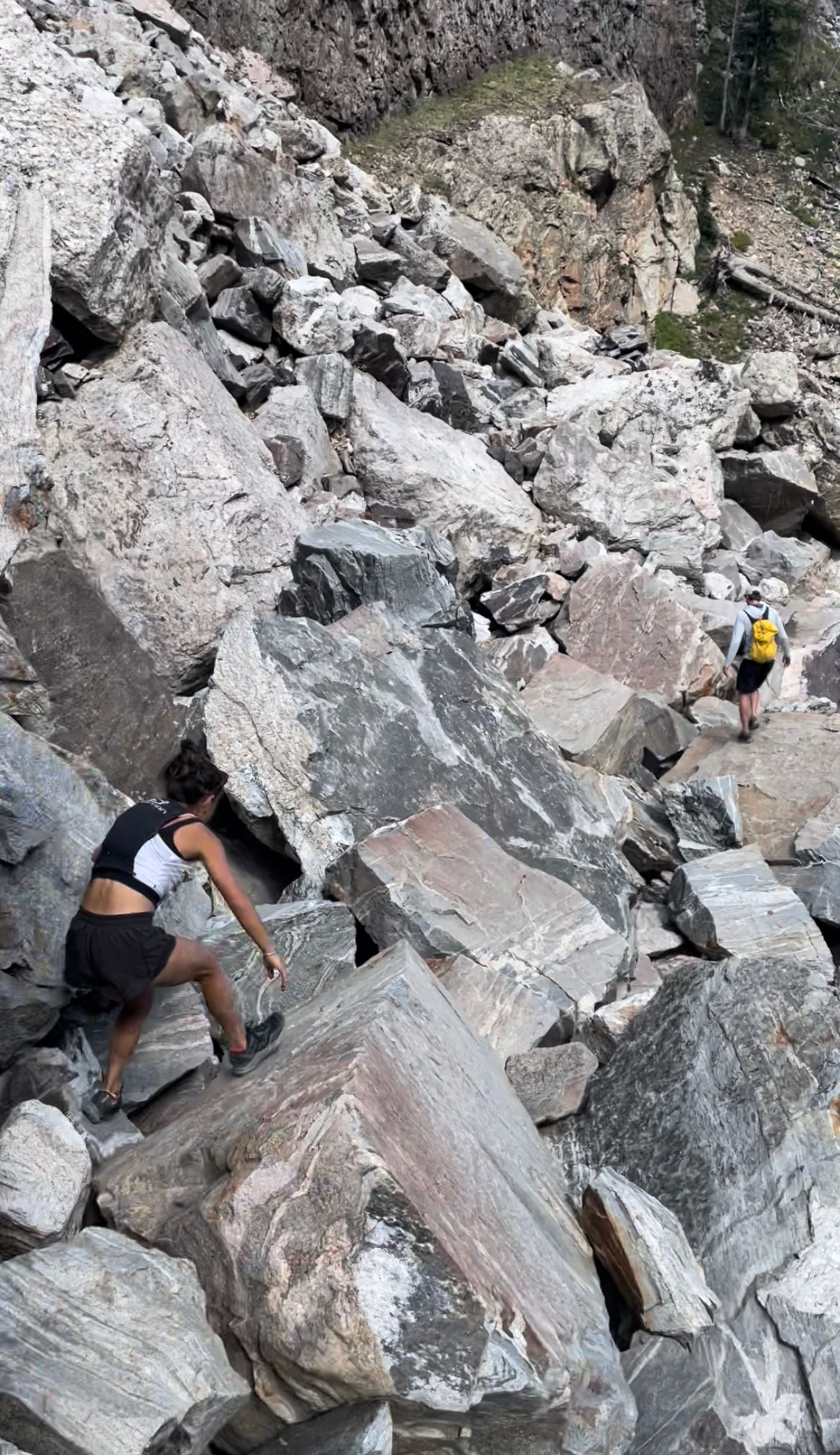
Downclimbing the Crawl (top left) and Belly Roll (top middle); Lower Saddle (top right); jogging through Garnet Canyon (bottom)
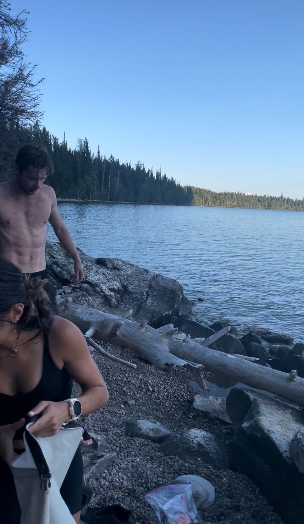
At 4:30pm, we rolled into Lupine Meadows, an 8.5-hour roundtrip, a full 2.5 hours faster than my dry run, thanks to pacing with Kelsey and Connor. Most of the time save was on the descent. The valley was probably 80F, perfect conditions for a refreshing return swim.
We jogged and hiked the last two miles along Jenny Lake to our wetsuits, dogging afternoon crowds. Ferries shuttle visitors across Jenny Lake every 10-15 minutes, plus plenty of hikers from the South Jenny Lake parking area. Kelsey was dreading the swim back, so we tried to pump her up.
We approached the ferry docks at 5:15pm, and to my relief, found our wetsuits still hanging by the beach. This time, we didn't have the Lake to ourselves. Every 15 minutes, a ferry with ~30 visitors pulled out from the docks and cruised by.
Jenny Lake trail (left/middle); beach near the ferry docks (right)
Connor goes commando in wetsuits. He thought he found a private spot to change. A few seconds later, he was mooning a boat-full of tourists on a passing ferry. Wetsuit stuck around his ankles, all Connor could do was blush.
My phone died, so I plugged in the portable charger, protected by a Ziplock bag for the swim. At 6pm, after some more snacks and water, we waded into the Lake.
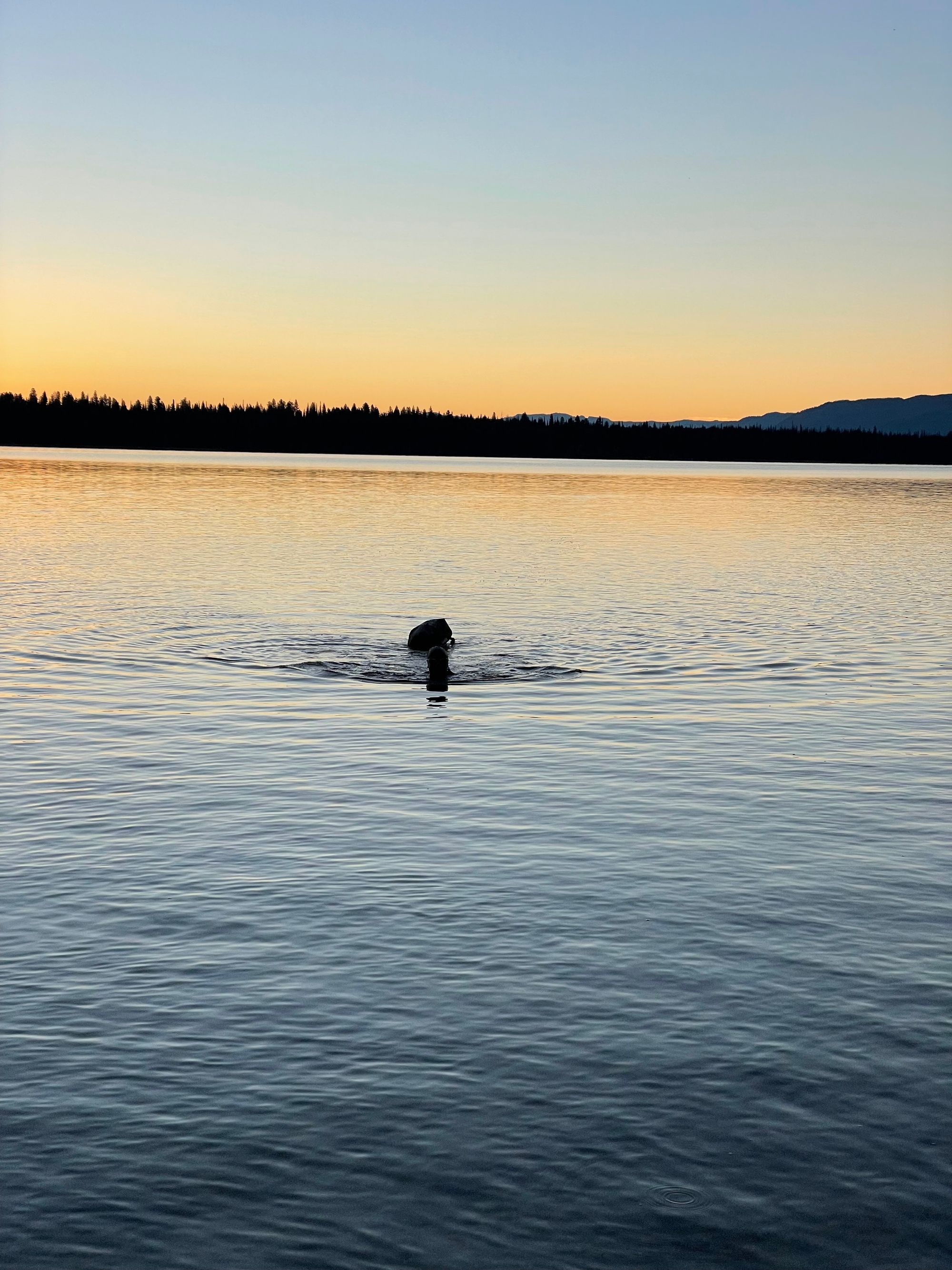
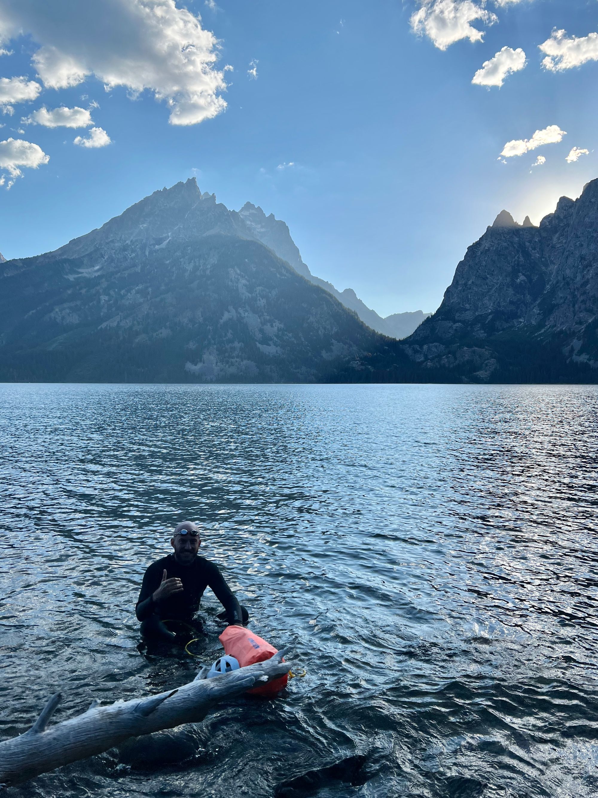
4. Return Swim (1.3mi)
Our return swim was more efficient and less eventful. My only worry was visibility to ferry captains, hoping they wouldn't run us over. In afternoon sun and after the Grand ascent, the swim was refreshing. We passed a few canoers and kayakers.
Able to use tinted goggles this time around, I alternated between freestyle and breast stroke. My right leg cramped a bit on breast, leading to more freestyle.
We approached a relatively crowded beach beneath the East Overlook, a few groups clustered at the water's edge. At 7pm, we stumbled onto the slippery rocks.
I was finally feeling fatigued, so the transition was sloppy. There was some chafing on my neck and shoulder due to the rental suit. I added electrolyte powder to my hydration bladder and ate my remaining food.
End of swim #2
By 7:30pm, we stumbled up the hill and back to our bikes.
5. Bike to Town (23mi)
I expected the bike home to be the easiest part. Out of the mountains and lake, we were back to civilization, a paved bike path.
But, I didn't account for the rental bike seat. Bruises settled on my inner thighs from the morning ride, thanks to ~14 hours between sessions. In retrospect, I should've popped a few Ibuprofen or wrapped my wetsuit around the seat. Each bump in the bike path forced me to my feet, reducing the impacts. (Turns out, the bike path had quite a few speed bumps.) I lagged behind Kelsey and Connor.
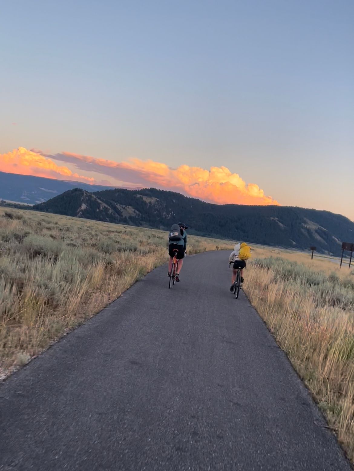
We rode past an elk herd just past Taggart (maybe the same herd we spooked that morning) and into a sunset. It would've been a perfect ride without bruised thighs. Needless to say, the return bike was much slower than the initial.
Shortly before the elk herd, my bladder valve broke and began spewing electrolyte solution. I halted the flow, but couldn't hydrate for the rest of the ride.
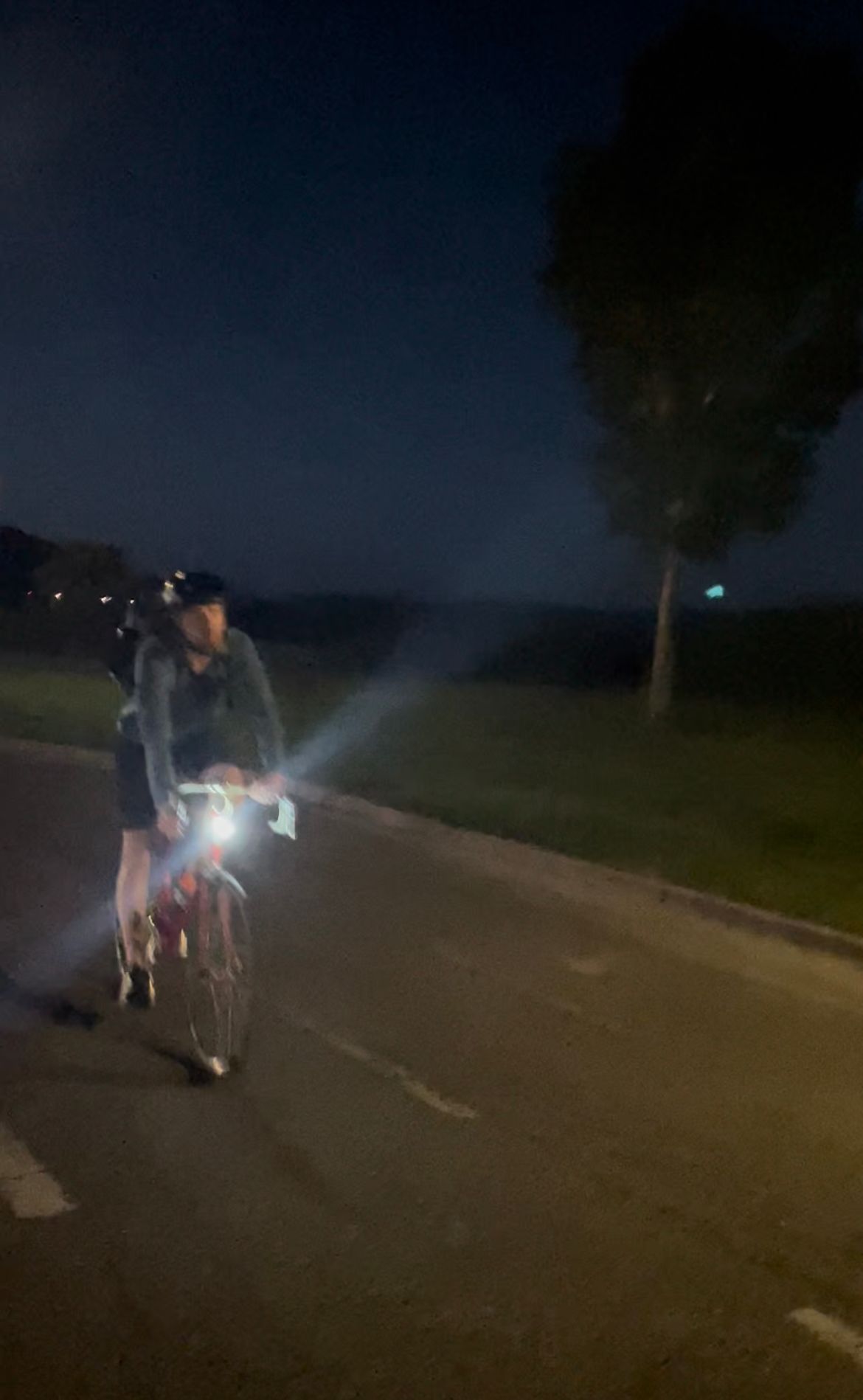
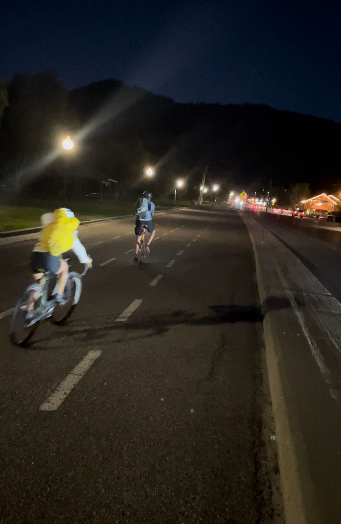
It was dark as we approached the Gros Ventre Butte near town. Past the Elk Refuge sign, the bike path runs along the road. Blinding headlights from oncoming cars interrupted our night vision, making the fast downhill section a rush.
Nonetheless, we made it to the home stretch, passing a couple bikers close to town.
Phases of bike #2
Finish Line
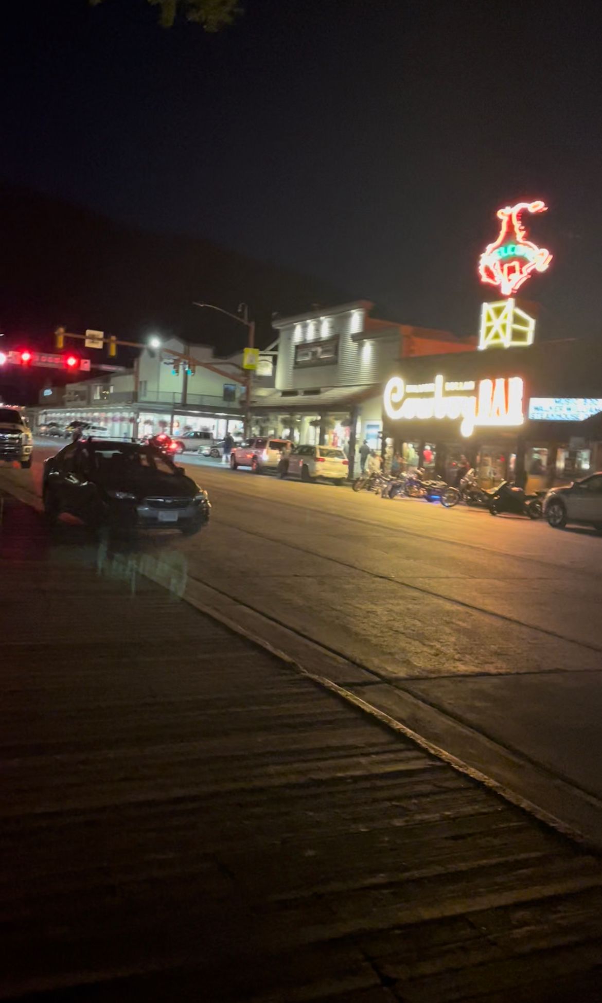
At 9:15pm, we rolled into the Town Square and parked beneath the northwest elk antler arch. Picnic complete.
We stumbled back to the cars and I haphazardly tossed gear into my truck bed. I scarfed down popcorn and water stashed in the cab. I was wiped, but aside from those nasty thigh bruises, had a bit more in the tank. I headed to Albertsons for more food, then fell into a 12-hour coma.
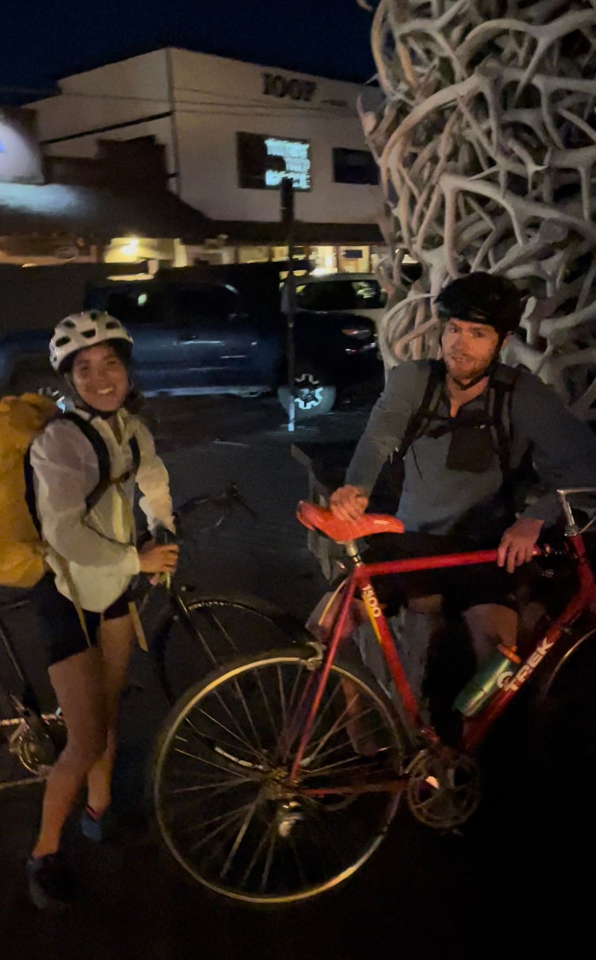
Biking through the finish line
Summer Up-Next for the Park
- Grand Teton's 5.5 Upper Exum route (crossed off in September: trip report).
- Grand Traverse.
- Mt. Moran's 5.5 CMC Face (also crossed off in September: trip report) and 5.4 Northeast Ridge.
- Mt. Moran's Moranic and Moronic Picnics.