Table Mountain Ski Tour
Mon, March 7, 2022:
- Left New Sheep Bridge Trailhead at 9:30am; returned at 6:30pm.
- 16 miles (including descent) and 4,500’ vertical ascent; 8 miles along Teton Canyon Rd (avoidable with a snowmobile).
- Successful summit; ski descent along our skin track and boot-pack.
Note: I may get commissions for purchases from certain links in this post.
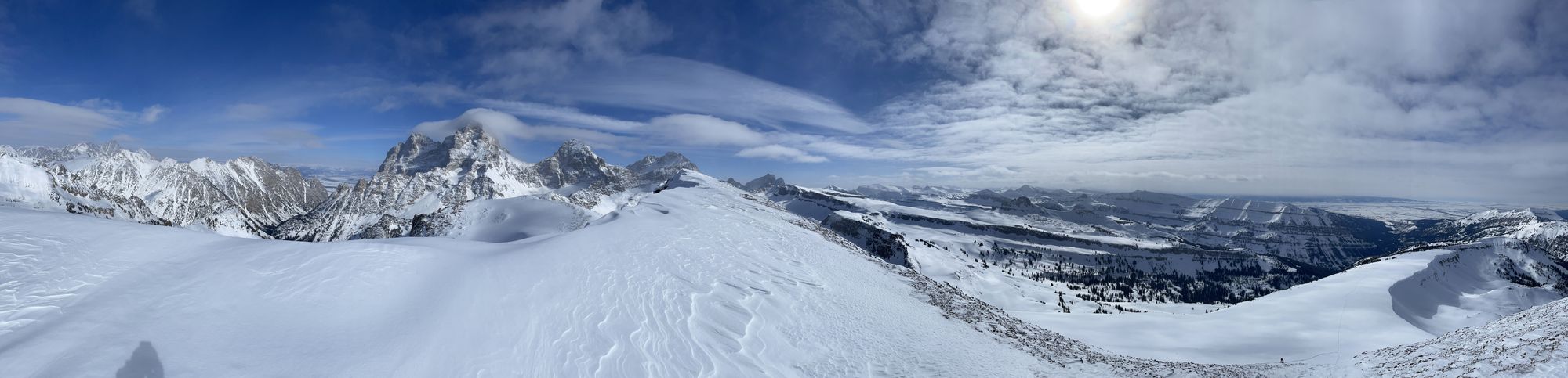
Table Mountain
Table Mountain is a Wyoming peak on the west side of the Tetons. The summit itself is only a mile west of Grand Teton, offering some of the most rewarding views of any Teton ascent. It's most readily accessible from Driggs, Idaho.
With unparalleled views of Grand, Middle and South Teton, Table Mountain is a very popular summer hike that starts at Teton Canyon trailhead. In the winter, the 4-mile stretch from New Sheep Bridge trailhead to Teton Canyon trailhead is groomed for nordic skiing.
Planning
Research and Forecasts
My partner for the trip, Nate, is based on the Idaho side of the Tetons and hiked Table Mountain in prior summers. Winter would be a first, but we had decent beta on the route.
We scouted Table the day before from Grand Targhee, a ski resort just northwest. The best vantage point is the saddle between Mary's Nipple and Peaked Mountain.
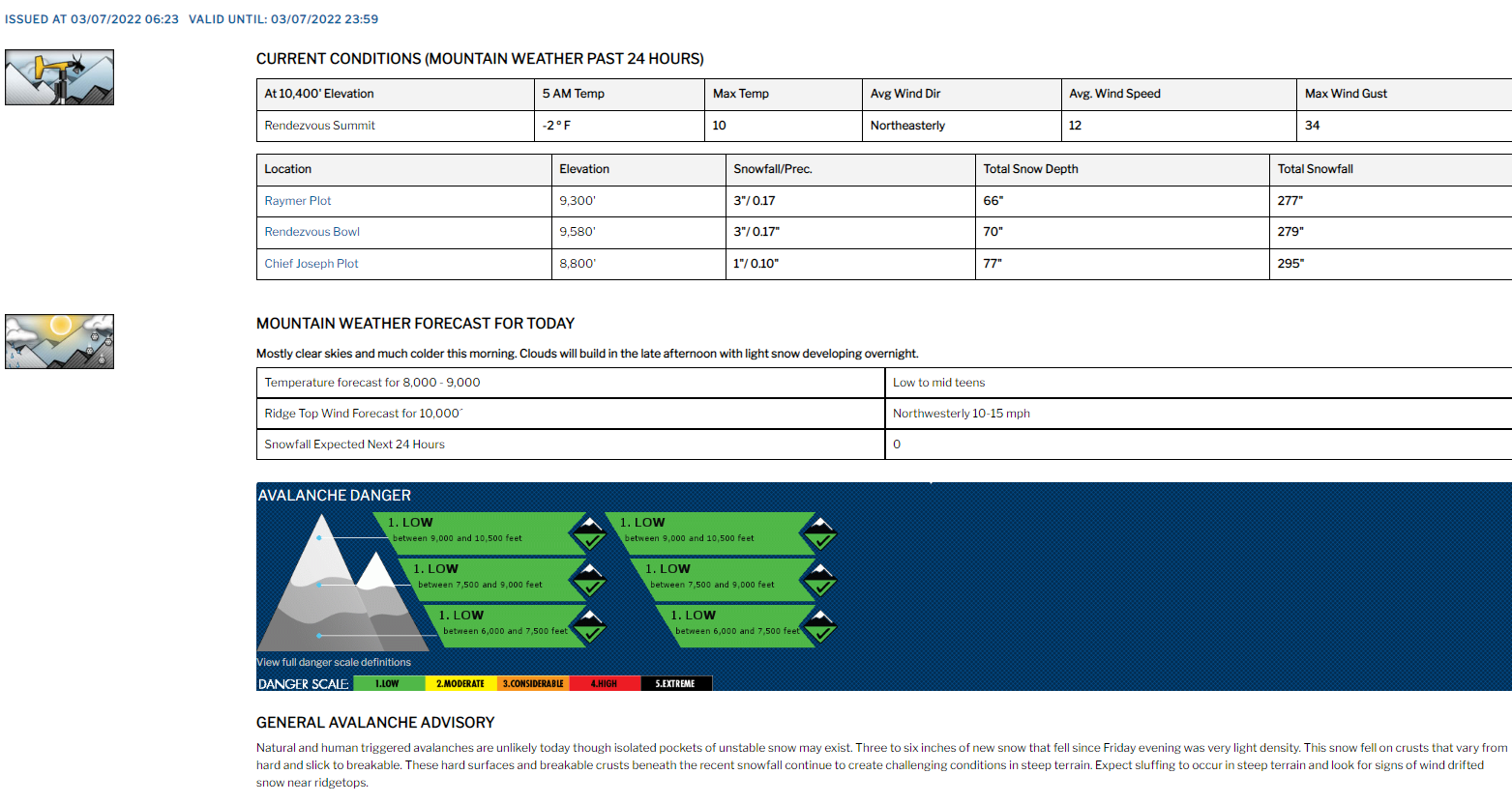
Winter 2021-22 was one of the driest on record. Constant high pressure systems in January / February, broken up by a couple 6" storms. We expected snow the day after our tour with flurries on its leading edge – otherwise a clear forecast.
Table Mountain has a few fun chutes and bowls. But as one of our first tours together, we planned to keep it conservative, descending along our skin track and bootpack back to the Teton Canyon Trailhead. With recent high pressure and cold temperatures, avalanche risk was all low. The upper ridgeline ranged from 15-20 degrees. It steepened when we reached dense trees along the bootpack.
We settled on a ~9am departure, enough time to beat the storm with a few spare daylight hours. Earlier would've been better, but I had a COVID test that morning, ahead of a Banff roadtrip in a couple days.
Gear
The night before, I packed gear and carbo-loaded. Table Mountain would be one of my first bigger tours, so I learned a ton and improved gear on subsequent tours.
See (comments) and a wish list below.
- Ski gear: Liberty Origin 190s with Salomon frame bindings (my super-heavy starter set-up – bought lighter skis and tech bindings before the Skillet in April); Black Diamond skins and skin savers; Nordica Strider hybrid boots; resort poles (need mid-grips and powder baskets); helmet
- Avalanche gear: Mammut Barryvox beacon, shovel and probe
- Ortovox 26L airbag pack with Voile straps to add outside capacity for skins, shell and helmet (need a larger pack); integrated back protector and whistle
- Ultralight medical kit: bandages, basic medications, antiseptics, tape, etc.; plus extra ibuprofen (knee overuse injury from the prior summer)
- Calories: granola bars and baby food (bad bang-for-weight; next time, more energy gels)
- 1L Nalgene of water with electrolyte powder
- Emergency gear: hand warmers, Leatherman multi-tool, fire starters and Coleman waterproof matches, space blankets and bandana
- Sunscreen
- GoPro with foam wind cover (helmet mounted)
- Repair kit: Gorilla tape (super duct tape); extra Voile straps (secure ski tips in A-frame carry, gear repairs, etc.)
- Black Diamond LED headlamp
- Extra AAA batteries for headlamp/beacon
- Smith goggles with high-light, low-light and clear lenses; sunglasses for the skin and bootpack
- Layers: Patagonia down sweater; Under Armor base upper; mid-weight sweater; Helly Hansen shell; North Face insulated ski pants (a bit too warm); Smartwool cushioned ski socks; neck gaiter with a fleece bottom (for sun and cold); lightweight gloves (ascent), mittens (final ascent) and liners (descent)
My partner also had a Garmin inReach as a backup.
Wish list for the next tour:
- Larger repair kit: baling wire, zip ties, hose clamps, etc.
- Extra electrolytes, energy gels (e.g., GU) and nut butters (e.g., Justin's) to replace high-water content baby food
- Lightweight touring skis and bindings (one pound on feet = five on back)
- Poles with mid-grips and powder baskets
- Higher-capacity touring backpack
The Trip
A Flat Skin
I drove west from a COVID-testing center near the old Kmart (now Target) at 8am. I was driving to Banff in a few days for a ski roadtrip and Canada required a negative test to enter. I planned to meet Nate at the Broulims in Driggs, then drive to the New Sheep Bridge trailhead in Teton Canyon.
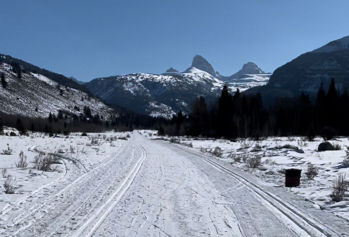
The adventure would start with a 4-mile skin on a groomed road to Teton Canyon Trailhead. It was mostly flat with a net 500' elevation gain.
Most skiers snowmobile to the start of their routes in Teton Canyon. Lacking a sled, we opted for the long skin. Mt. Moran's Skillet was on my wish list for that spring. Before Jackson Lake thaws, the Skillet involves a 6-mile skin over the frozen surface. This extra mileage would be a good a trial run. (Check out our trip report from an April 2022 attempt; we fell 1,000' short.)
We talked about going "Nordic" (free heel; no skins), but the route wasn't quite flat enough to make that more efficient.
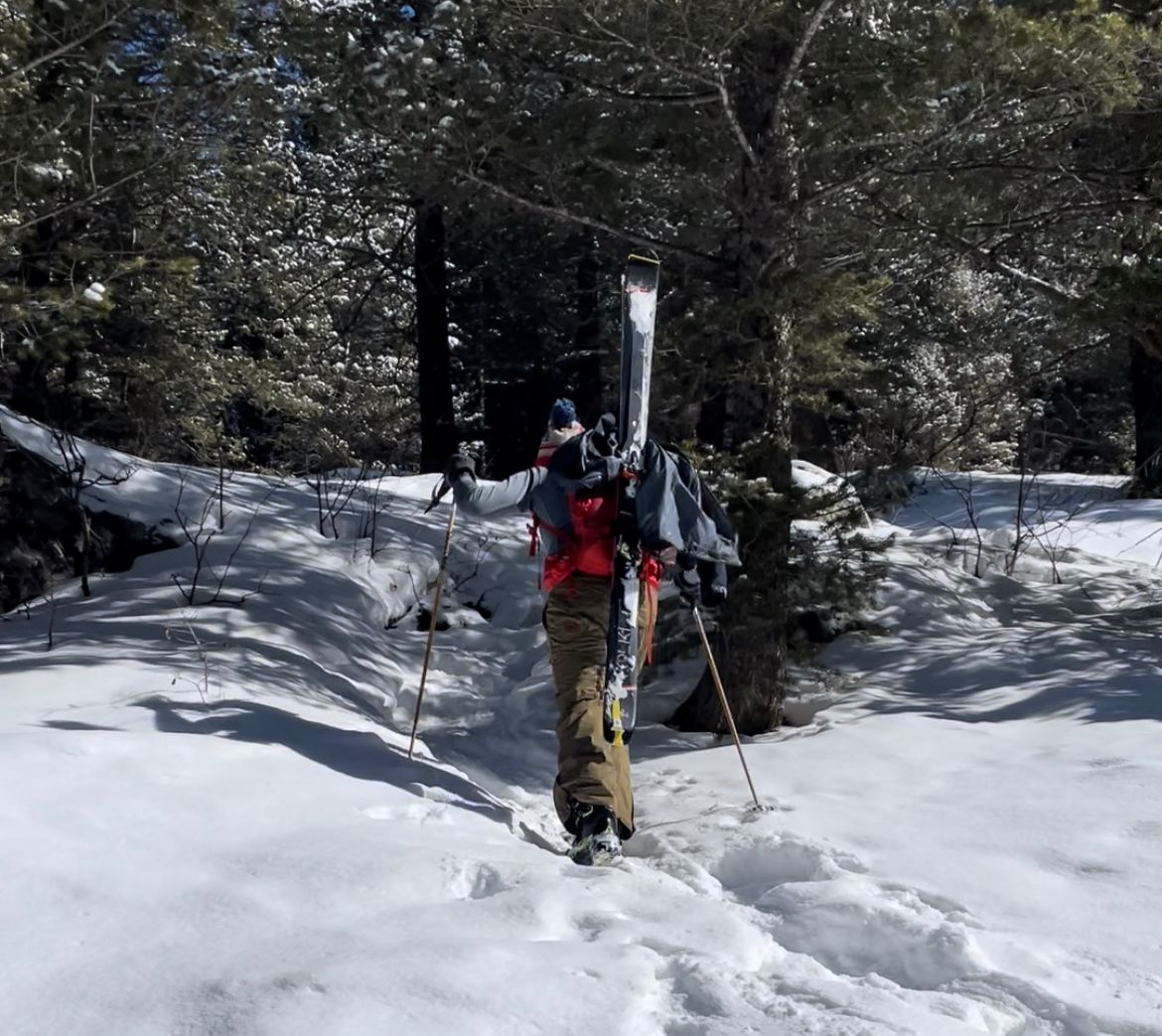
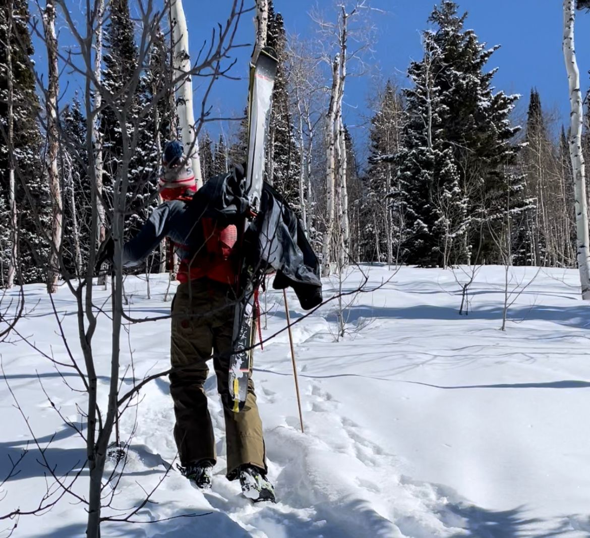
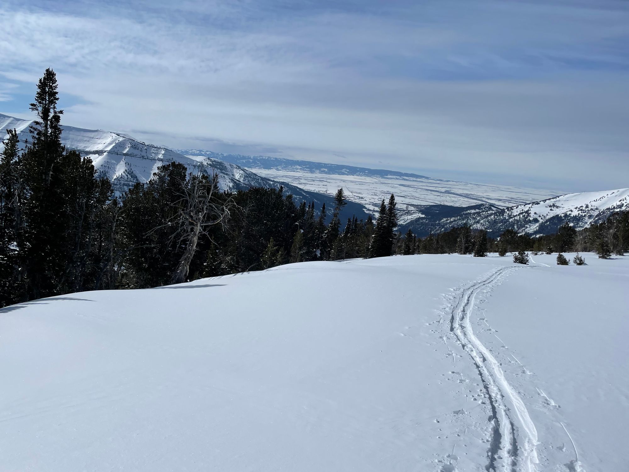
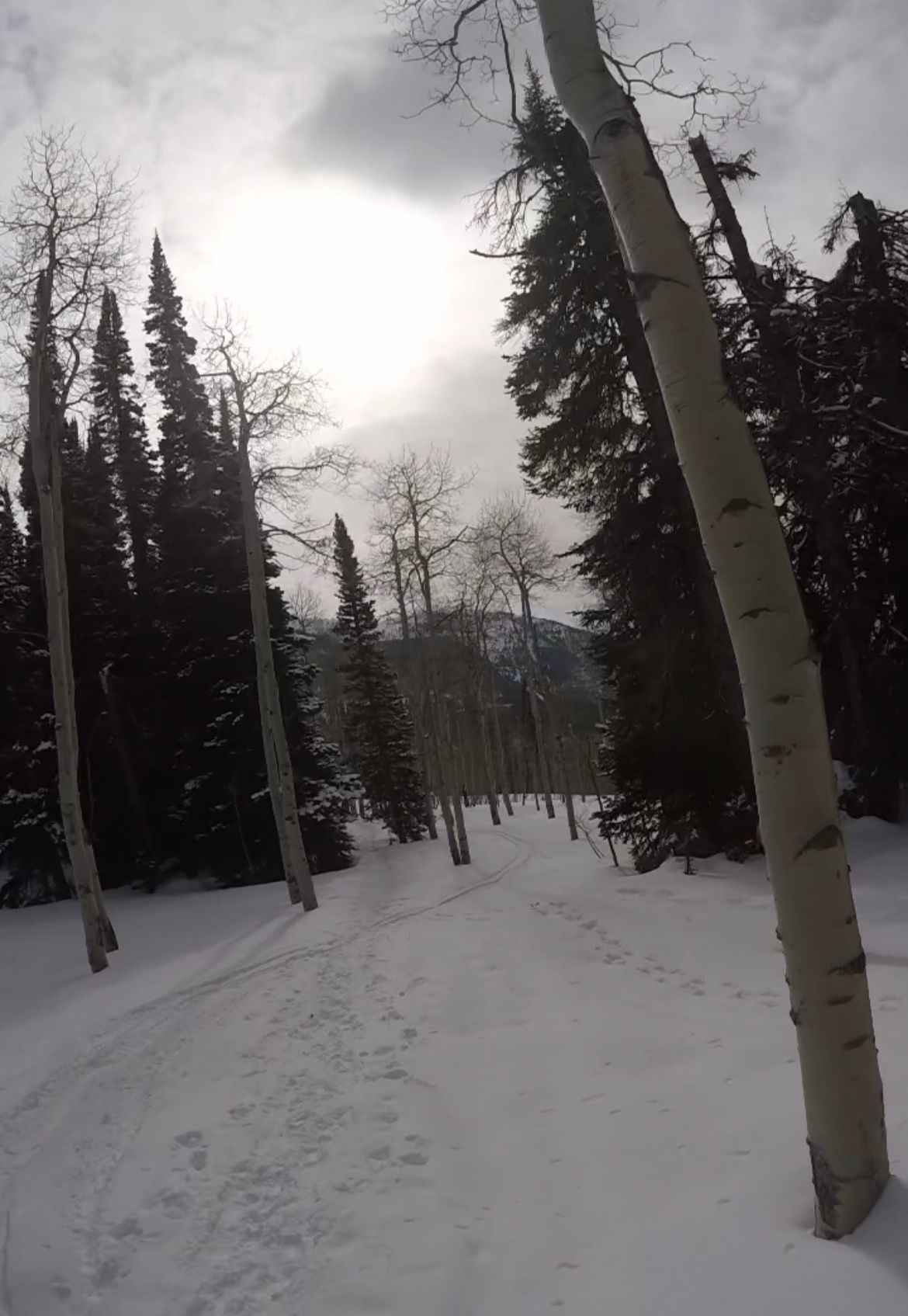
At 9:30am, we skinned out of Sheep Bridge trailhead, passing nordic skiers and some pups returning from early walks. The road meanders through Teton Canyon and over a couple bridges before reaching the dead-end: Teton Canyon trailhead.
The Idaho-side of the Tetons offers stark contrast. The western edge of the Tetons isn't as steep as its fault line in the east. The range's highest summits – Owen, Grand, Middle and South – are more pronounced, rising above the foothills.
A few snowmobiles zipped past as we skinned. One sled had three skiers in tow, sparking some envy. By 11am, we arrived at Teton Canyon trailhead and transitioned for the bootpack.
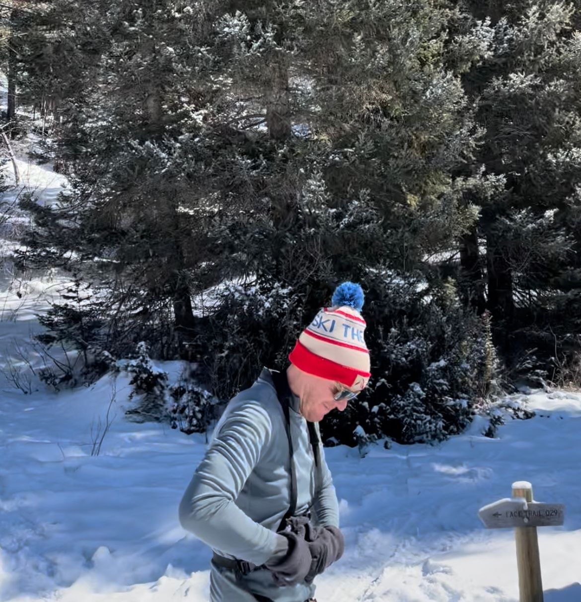
Leaving New Sheep Bridge; bootpack transition at Teton Canyon
Bootpack from Teton Canyon Trailhead
Beacon check, skis in A-frame mode and a quick snack. We followed snowshoe tracks just left of the trailhead restrooms, closed for the season. Our elevation gain would be 4,000' from the trailhead.
We were lucky to find snowshoe tracks that supported our weight. Bootpacking the ridge would be faster than switchbacking on skins. (Occasionally our boots punched through the snow, but not often.)
We trudged up a couple steep sections of pines and aspen groves. The snowshoe tracks followed Table's northwest ridge. There were only a few clouds in the sky. Periodically Nate pointed out surrounding summits. We observed Treasure Mtn. cliff bands to our west dropping beneath us as we climbed.
After ~2,200' and 2 hours, the terrain leveled out. We transitioned to skin the final 1,800' to the summit.
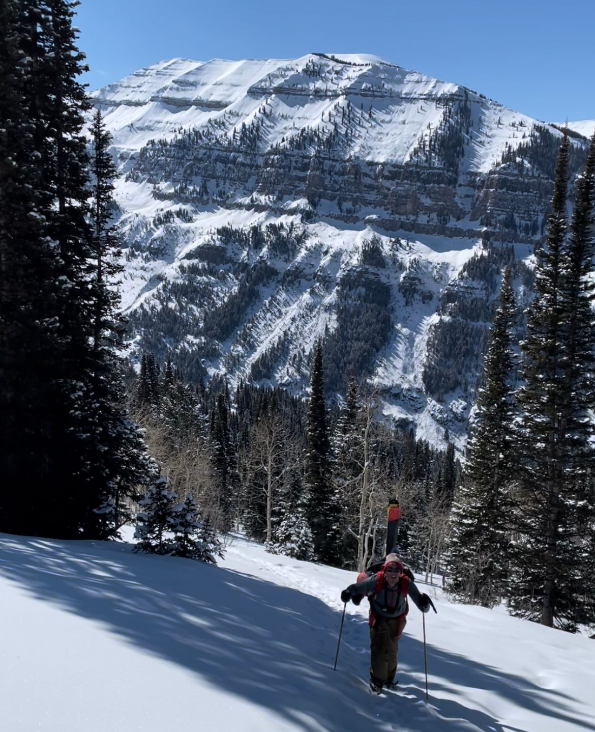
Bootpacking up Table's northwest ridge
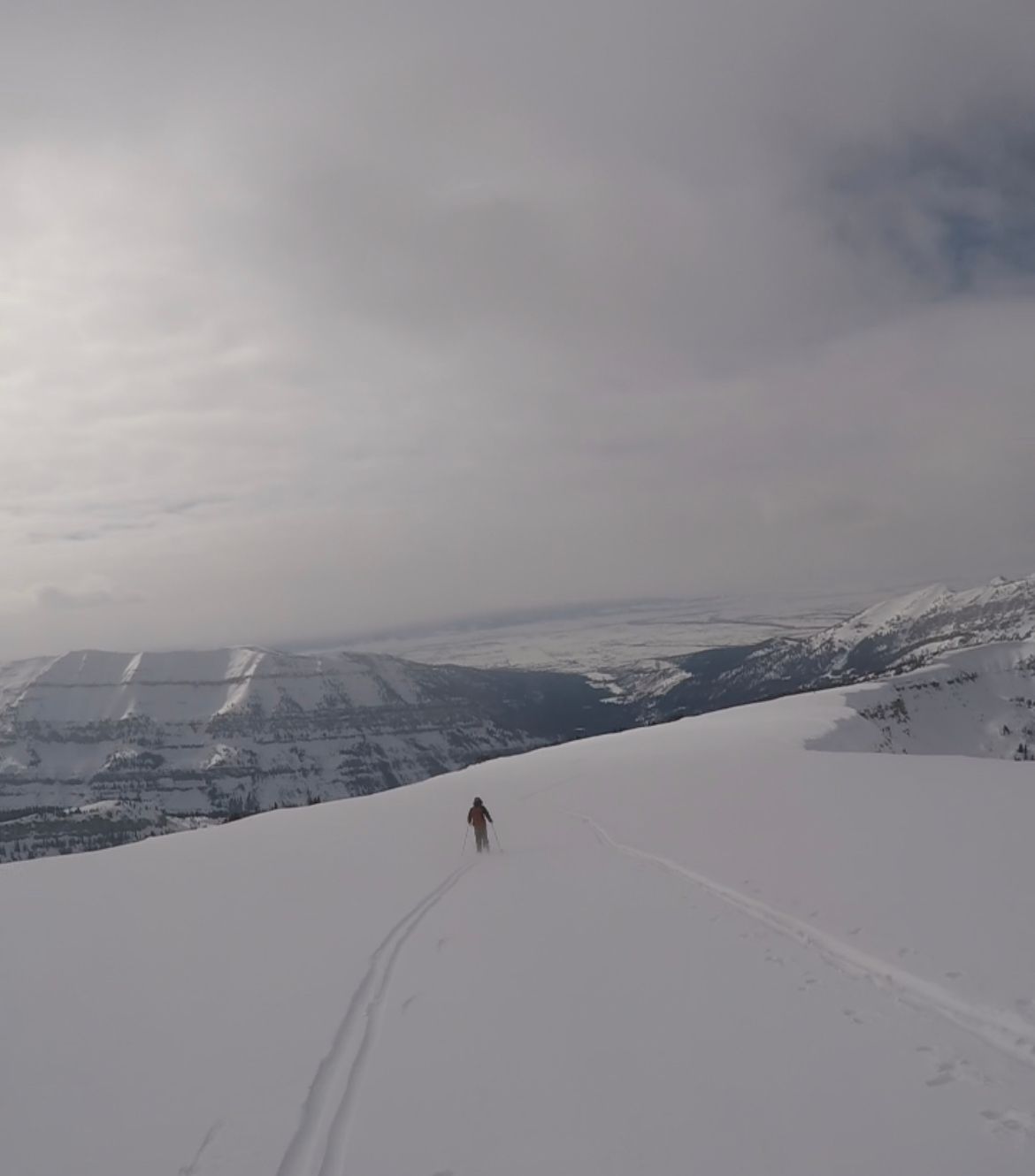
Skin (and Bear Crawl) to the Summit
After a quick snack break, we ripped skins and started heading southeast. We'd follow the ridge to the summit, which wasn't yet visible. It was 1pm.
The skin seemed to drag on. I really needed to upgrade my heavy frame bindings. The summit came into view within 30-40 minutes. Most of the ridgeline is 15-20 degrees, lacking trees / boulders to judge distance. My hands were freezing, so I swapped lightweight glovers for mittens.
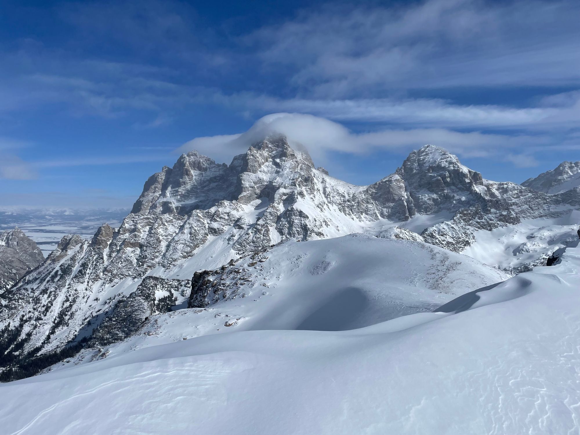
Nate pointed our Battleship Mtn. to our south. It was my first time summiting a mountain in the winter. I soaked up the snowy Teton vistas. The Cathedral Group disappeared behind the Table summit as we approached.
With clouds rolling into Teton Valley to the west and a storm in the overnight forecast, we debated turning around a mile from the summit. A cornice hung to the north of the ridge and there were limited reference points to keep us safe if visibility dropped. (It's safer to ski trees in a white-out.)
The clouds were still aways out, so we kept ascending.
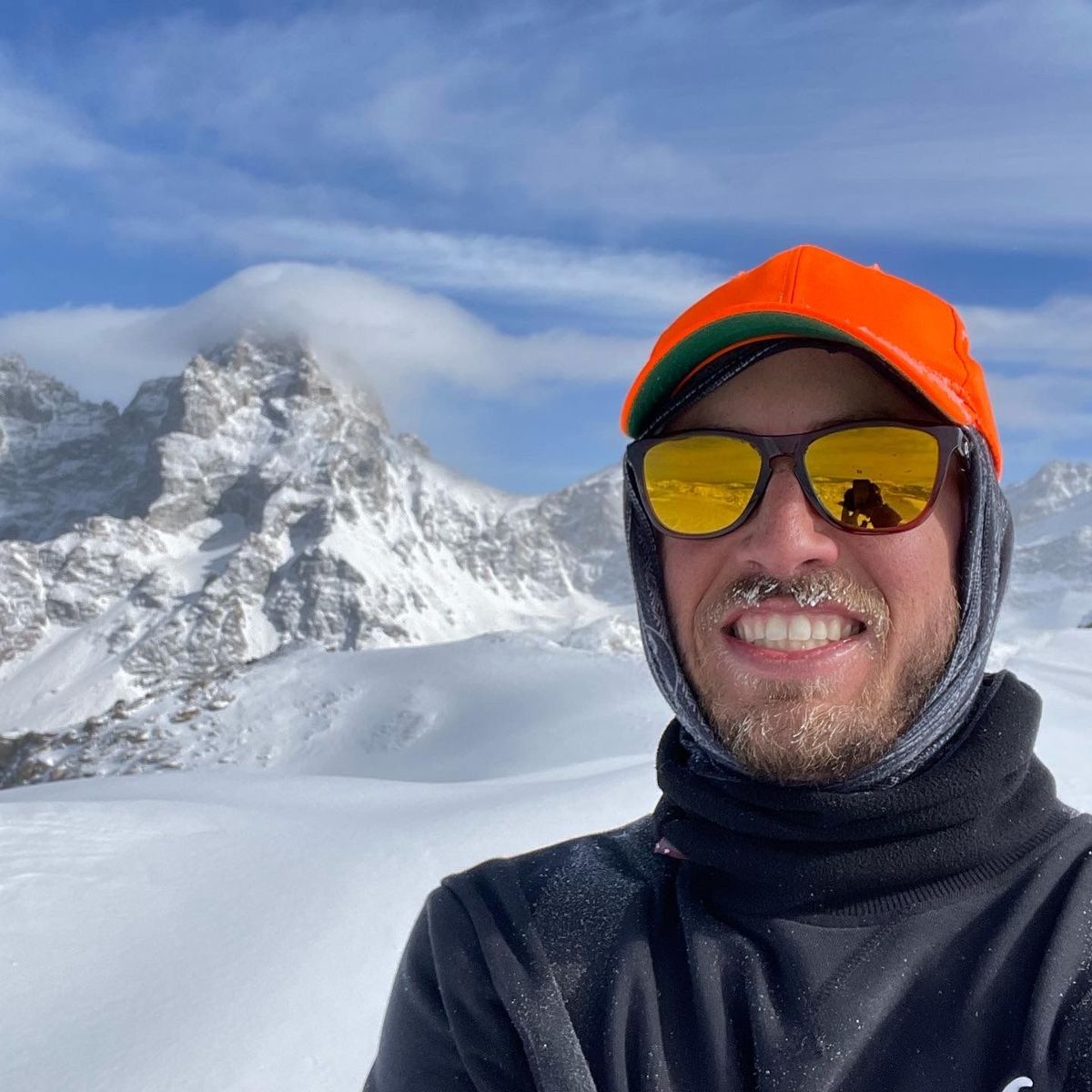
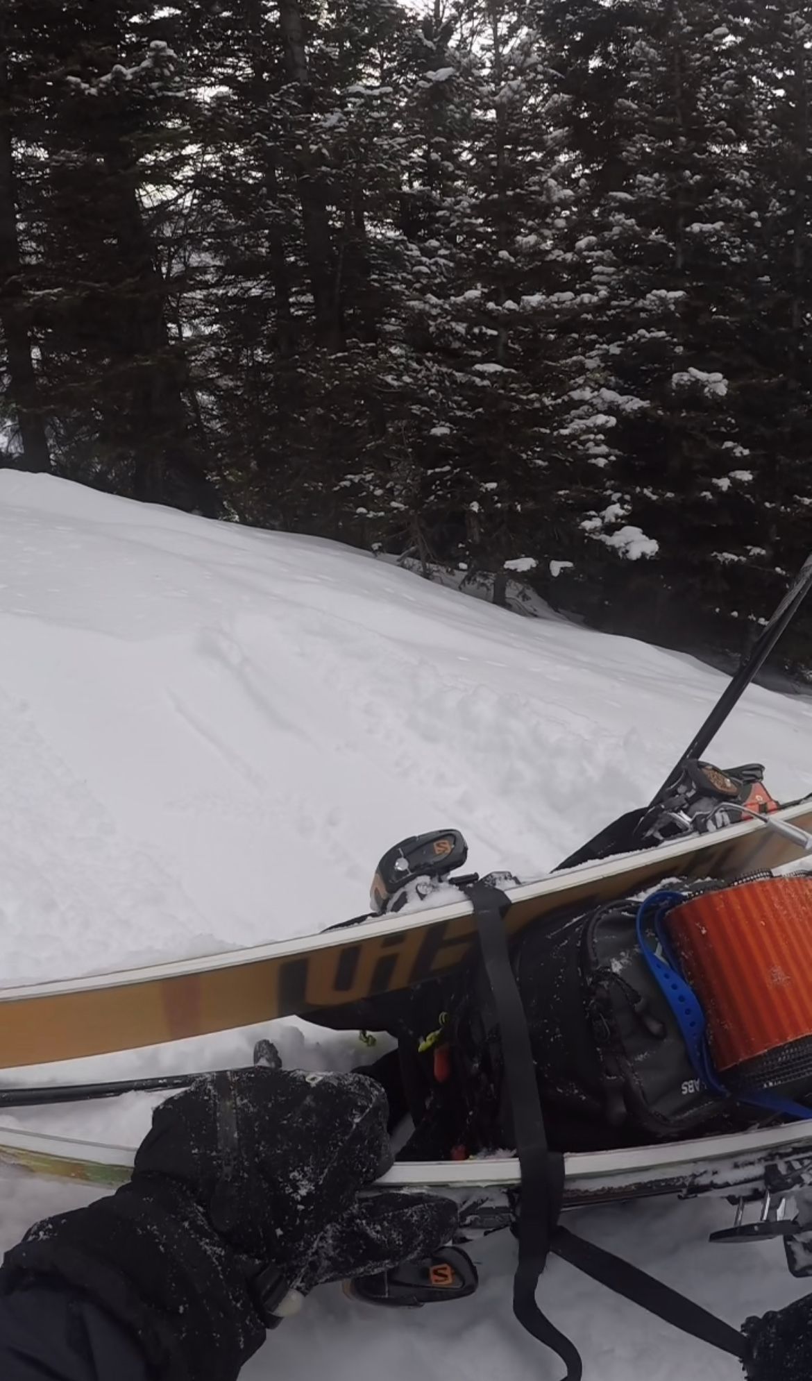
By 2:30pm, an hour and a half into our skin, we neared the summit. The slope steepend to 30–40 degrees. I ditched my skis and pack, bear crawling the final 100' with poles in hand. The snow was soft – no crampons / axe needed.
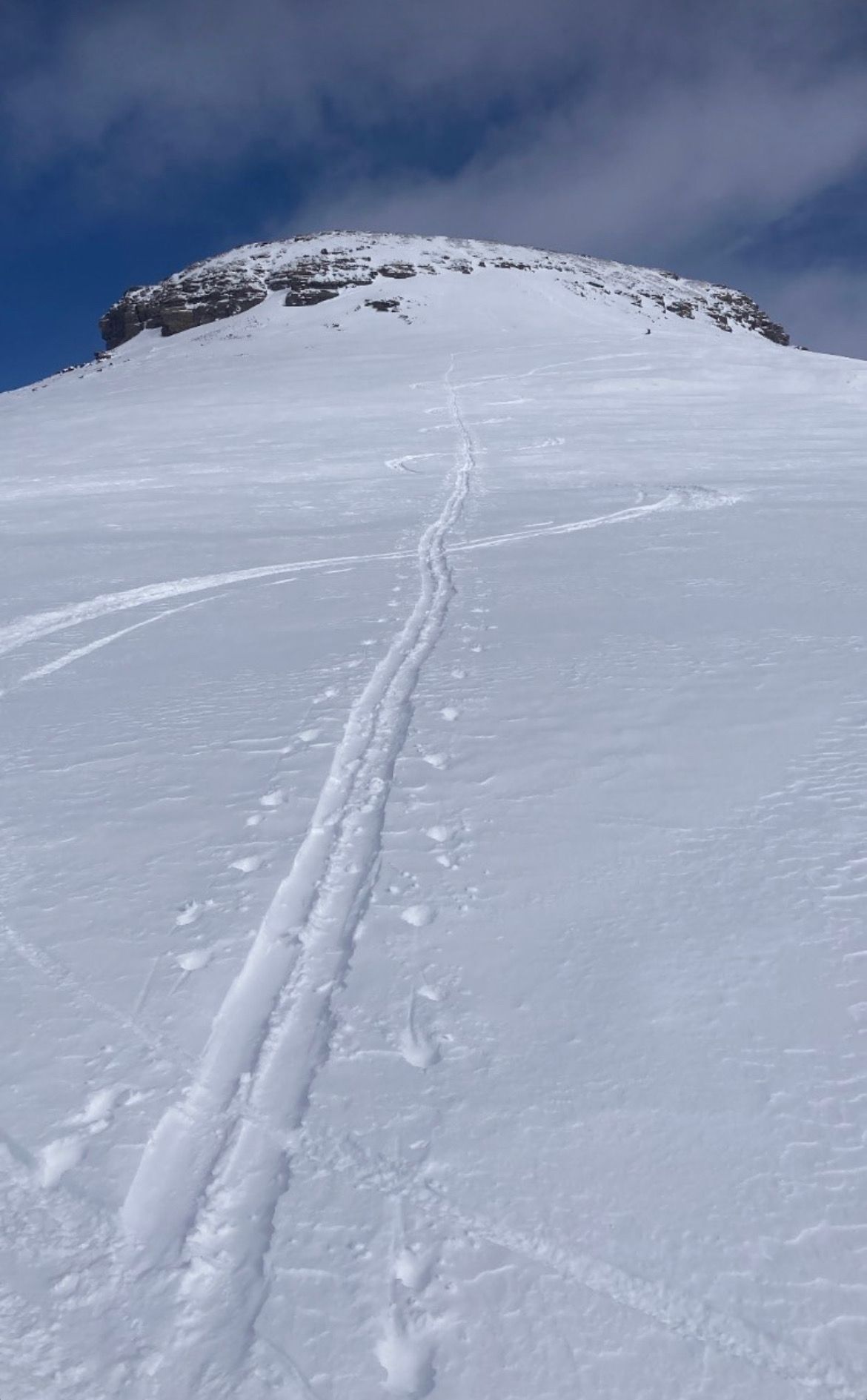
Final approach and summit
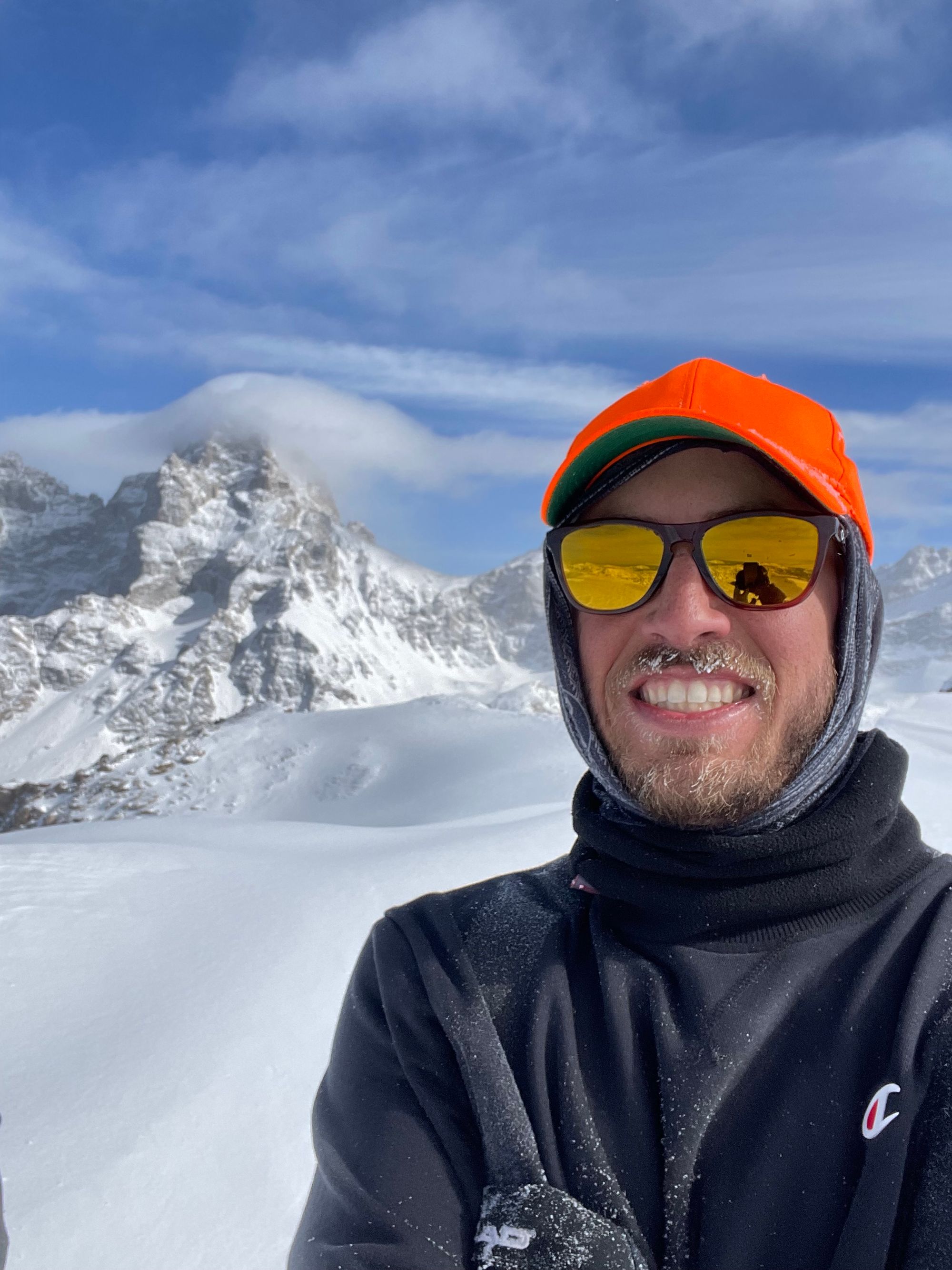
Careful to avoid from the leeward edge, I snapped some quick pictures on the summit, then scrambled out of the cold, west wind. (Cornices have a habit of breaking further back than expected.) I slid on my butt through the rock fins below the summit, using my poles to break.
Back to my skis, I transitioned. I felt my hands growing numb – the 30 seconds of exposure for pictures took its toll. I added liners beneath the mittens, swapped my frozen sweater for a puffer and added my shell.
Hands slow, my transition was clumsy. By 3pm skins were packed, frame bindings in downhill mode and helmet buckled.
Ridgeline to our Bootpack
My legs felt like jelly. This was my first long tour. Prior ascents were limited to 1,500-2,000' vertical. I also skied Targhee and deadlifted the day prior – rookie move in retrospect. More calories would've helped.
With a clumsy start, I planned to ski conservatively back to the trailhead.
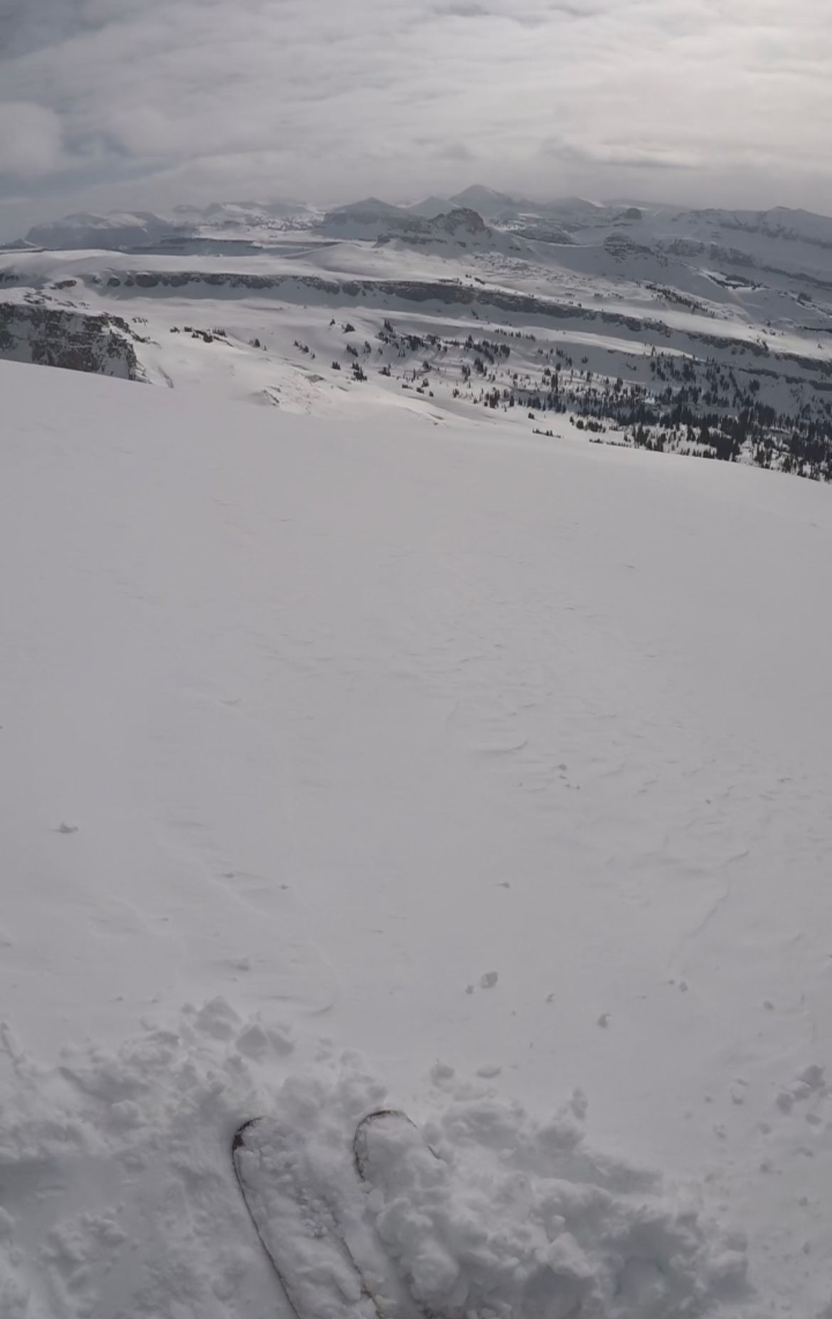
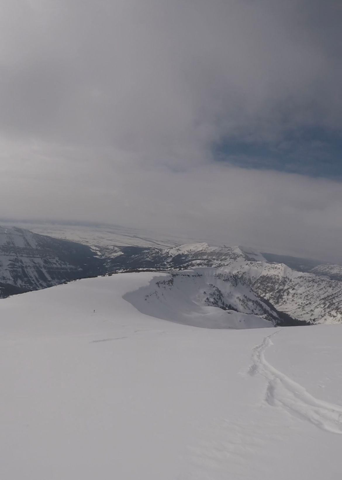
Ridgeline ski descent
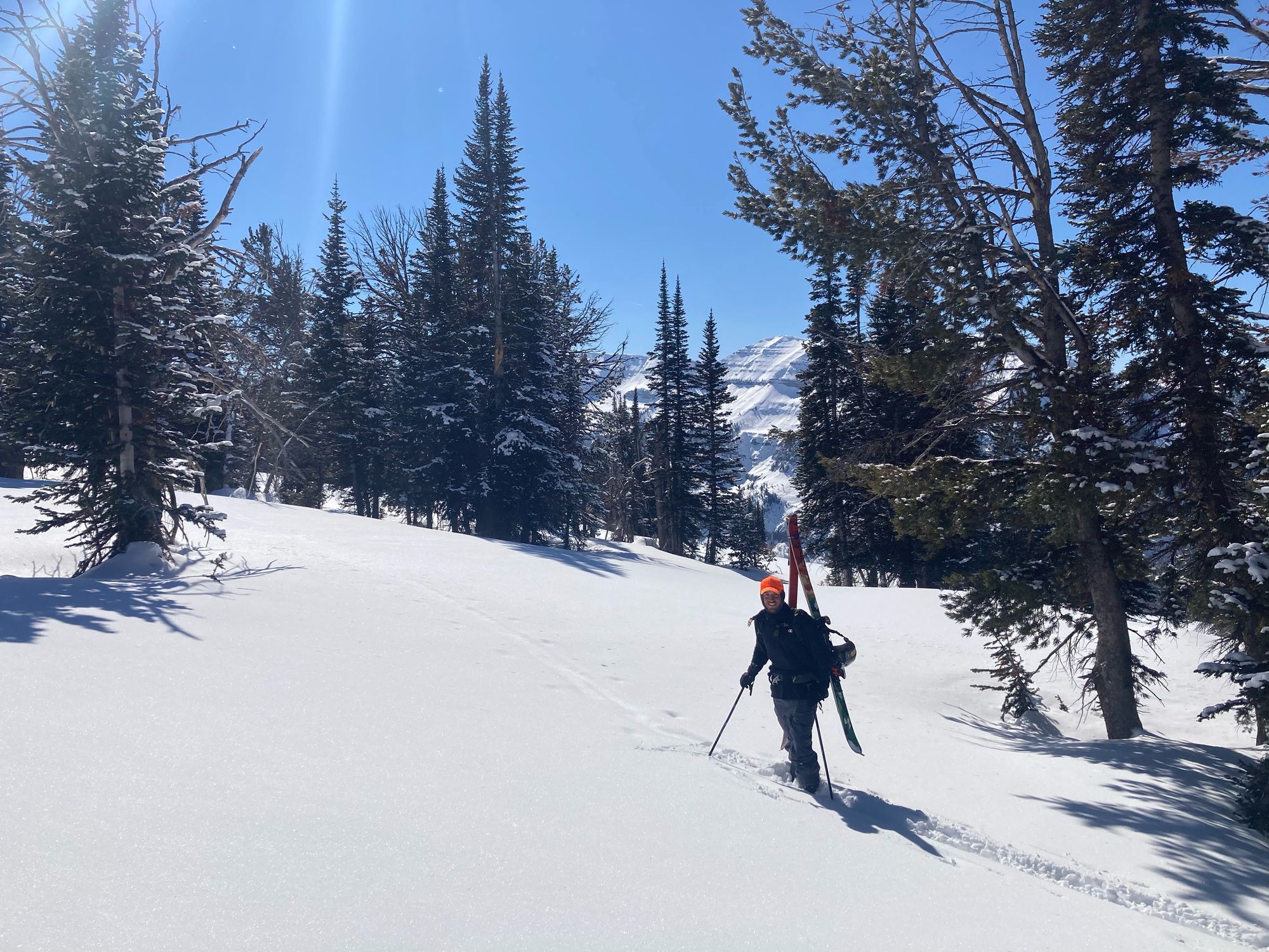
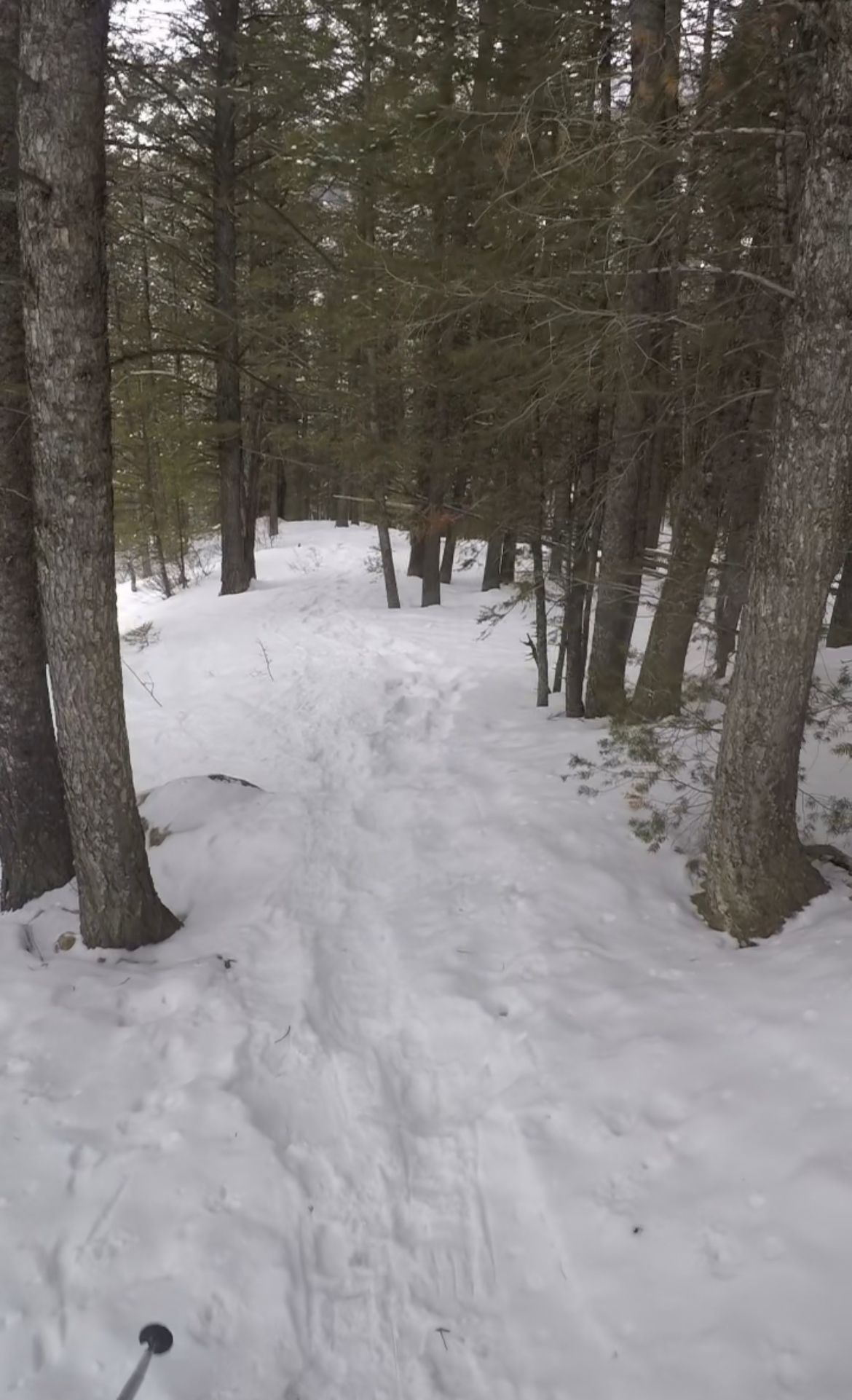
We followed our skin track and then bootpack back down the ridge. A few fresh inches of snow from the night before sat on firm snow. For the driest January / February in recent history, I'd take it.
As we descended, snow coverage dropped – less fresh snow and more crusts. When we hit the steeper section with tight trees, we transitioned to bootpack. Our legs were spent and coverage was mediocre.
Transition to bootpack
Skis on backs, we hiked down the same snowshoe track we ascended a few hours earlier. Occasionally our boots broke through, which felt riskier facing downhill. I took it slow to minimize injury risk.
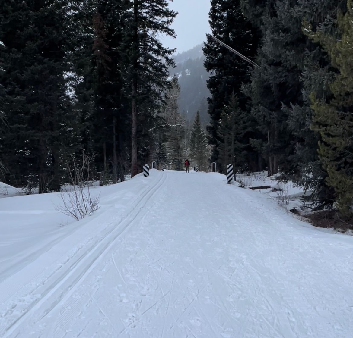
At 5pm, we reached the Teton Canyon trailhead, took a quick breather and transitioned for the final skin home.
Final, Flat Skin
That final, flat skin was uneventful, but felt longer than in the morning. We passed one group of hikers halfway back to our cars. Envy of the snowmobile shuttle hit again, but this would be a good trial for the Skillet.
At 6:30pm, we reached our cars. I took a few gulps of water from a jug in my truck and packed up.
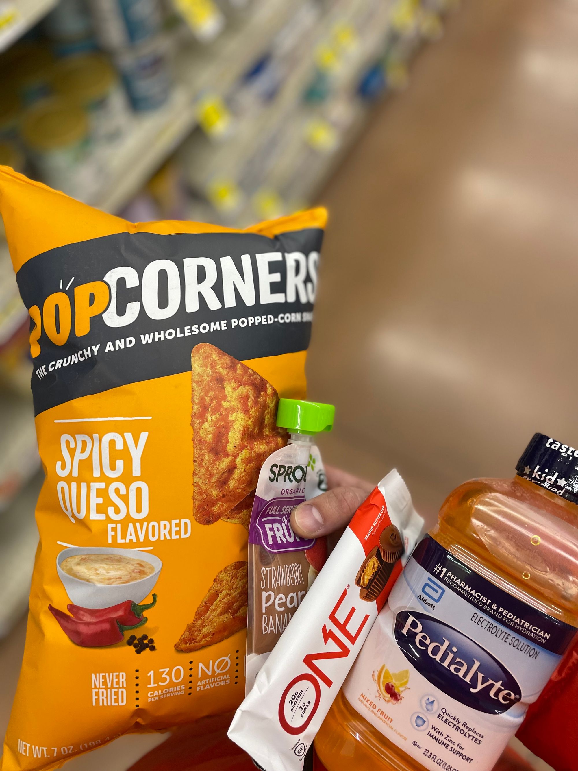
Next order of business: Broulim's in Driggs for Pedialyte, a protein bar, baby food and my favorite snack: Spicy Queso Popcorners. Then, an hour drive back to Jackson over Teton Pass.
Snow was picking up, so the drive home was slower than I hoped. Treating myself at home, I whipped up a quick steak with onions / mushrooms and baked potato wedges – a light 9pm dinner.
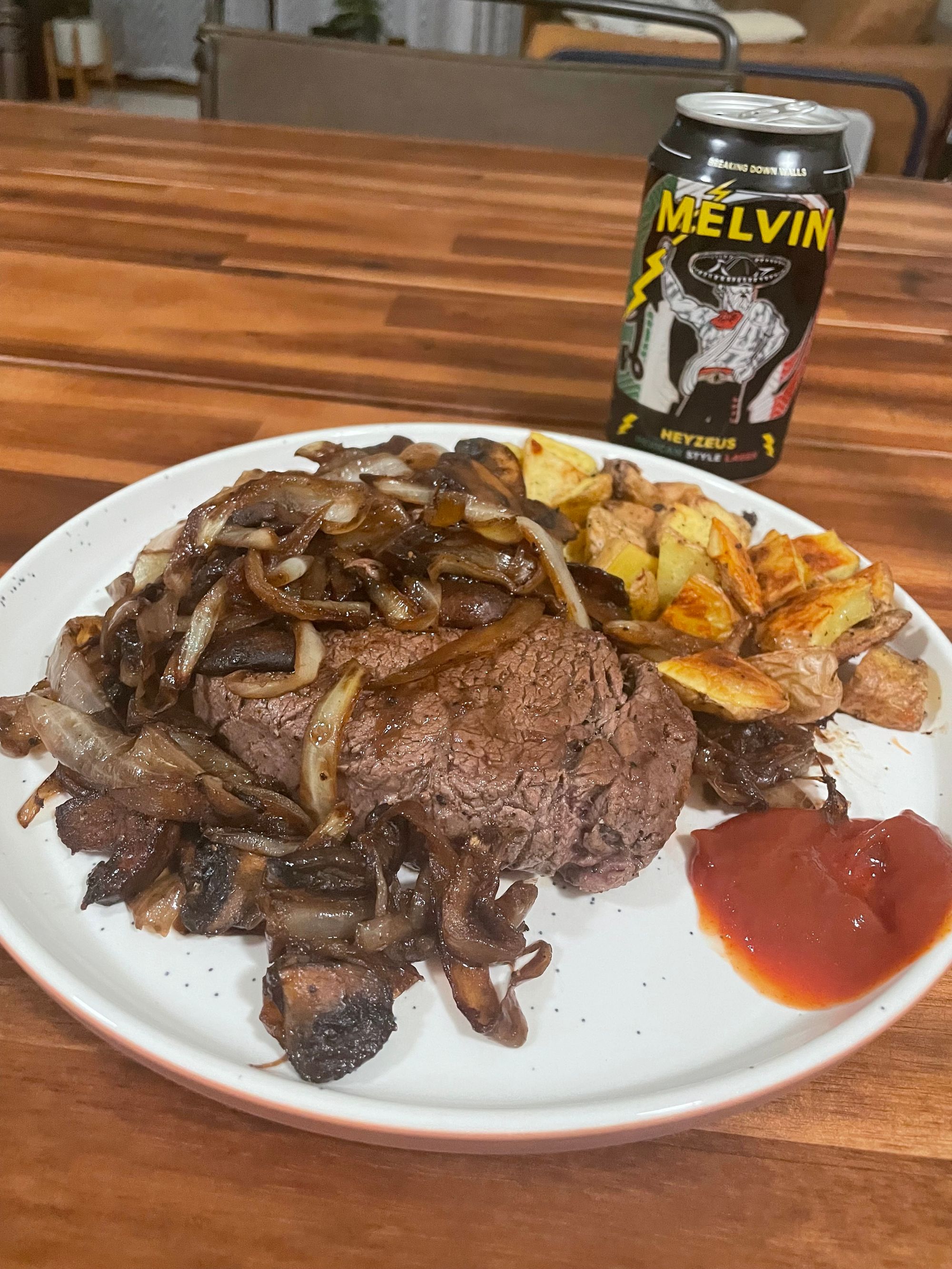
Final skin and snacks / a light dinner
Takeaways
- More calories, specifically denser options like energy gels and Justin's packs
- More water with electrolytes
- No leg workouts the day before a long tour (duh)
- More carbo-loading / hydration in advance
- Lighter touring equipment
Stats from Apple Watch
- 16 miles, including ski descent, and 4,500' vertical (500' initial skin, 2,200' bootpack and 1,800' final skin / bear crawl)
- 2,500 active calories